


Maps & Atlases
2,186 Results
Sort by:
Best Match
Categories
Location & Shipping
Payment Method
House Rating
Creator
Style / Period
Material / Technique
Origin
Auction House
Current Bid
Est. Price Range
![1636 Hondius Map of Southern Spain -- Andaluzia continens Sevillam et Cordubam: Title: 1636 Hondius Map of Southern Spain -- Andaluzia continens Sevillam et Cordubam Cartographer: Hondius [family] Year / Place: 1636, Amsterdam Map Dimension (in.): 13.8 X 19.4 in. This is a handso](https://p1.liveauctioneers.com/5584/331526/178834458_1_x.jpg?height=310&quality=70&version=1717530687)


![[Maps & Atlases] Oliva, Joan: Portolan Chart of the Mediterranean: [Maps & Atlases] Oliva, Joan: Portolan Chart of the Mediterranean Oliva, Joan Portolan Chart of the Mediterranean Marseille, 1615. Illuminated manuscript portolan chart on vellum, in red, blue, green,](https://p1.liveauctioneers.com/65/332523/179335172_1_x.jpg?height=310&quality=70&version=1717709445)


![Set of Twelve Satirical Anthropomorphic Maps of Europe: [SATIRICAL MAPS] A set of twelve satirical anthropomorphic maps of Europe. London: circa 1868. A set of 12 (believed complete) lithographed maps by Vincent Brooks, Day & Son, London, each offering](https://p1.liveauctioneers.com/292/330597/178279264_1_x.jpg?height=310&quality=70&version=1716409282)


![[Maps & Atlases] Seutter, Matth(ias).: Novus Orbis sive America...: [Maps & Atlases] Seutter, Matth(ias).: Novus Orbis sive America... Seutter, Matth(ias). Novus Orbis sive America Meridionalis et Septentrionalis… Augsburg, ca. 1730. Engraved hand-colored map of](https://p1.liveauctioneers.com/65/332523/179335174_1_x.jpg?height=310&quality=70&version=1717709447)
![[Maps & Atlases] A New Map of North America, with the West India Islands...: [Maps & Atlases] A New Map of North America, with the West India Islands... A New Map of North America, with the West India Islands. Divided according to the Preliminary Articles of Peace, Signed at V](https://p1.liveauctioneers.com/65/332523/179335173_1_x.jpg?height=310&quality=70&version=1717709447)


View:
24
News about Maps & Atlases
Historic maps and atlases chart course to Swann Dec. 7
[av_heading heading=’Historic maps and atlases chart course to Swann Dec. 7′ tag=’h1′ style=” subheading_active=” show_icon=” icon=’ue800′ font=’entypo-fontello’ size=” av-desktop-font-size-title=” av-medium-font-size-title=” av-small-font-size-title=” av-mini-font-size-title=” subheading_size=” av-desktop-font-size=” av-medium-font-size=” av-small-font-size=” av-mini-font-size=” icon_size=” av-desktop-font-size-1=” av-medium-font-size-1=” av-small-font-size-1=” av-mini-font-size-1=” color=” custom_font=” subheading_color=” seperator_color=” icon_color=” margin=’,,35px,’ av-desktop-margin=” av-desktop-margin_sync=’true’ av-medium-margin=” av-medium-margin_sync=’true’ av-small-margin=’,,20px,’ av-mini-margin=” av-mini-margin_sync=’true’ headline_padding=” headline_padding_sync=’true’ av-desktop-headline_padding=” av-desktop-headline_padding_sync=’true’ av-medium-headline_padding=” av-medium-headline_padding_sync=’true’ av-small-headline_padding=” av-small-headline_padding_sync=’true’ av-mini-headline_padding=” av-mini-headline_padding_sync=’true’ […]

Celebration of Scottish engineering on display at Lyon & Turnbull Feb. 7
EDINBURGH – A cache of material from a well-known Scottish engineering dynasty will be offered at Lyon & Turnbull. The Rare Books, Manuscripts, Maps & Photographs auction on Wednesday, February 7 includes 50 lots from the Stevenson family – designers across four generations of many of the U.K.’s lighthouses. Absentee and Internet live bidding will […]

Dickens & Twain set world records at Potter & Potter Aug. 28
CHICAGO – Potter and Potter‘s spectacular August 28 Fine Books and Manuscripts Sale was the company’s highest-grossing auction to date. After a day of spirited bidding, 107 lots realized between $1,000-4,999; 22 lots realized between $5,000-9,999; and 16 lots broke the five digit mark.
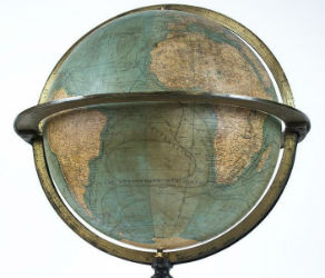
Jasper52 vintage map auction Nov. 5 going global
NEW YORK – A 19th century French terrestrial globe tops an auction of vintage maps that will be conducted by Jasper52 on Tuesday, Nov. 5. Fifteen globes and more than 130 maps and atlases are offered in the online auction. Bid absentee or live online exclusively through LiveAuctioneers.
TOP