


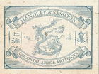
c.1851 Map China & Birmah View of Hong Kong, J.Tallis, London
Similar Sale History
View More Items in Maps & Atlases


Related Maps & Atlases


![1582 Braun and Hogenberg View of Halberstadt and Quedlinburg in Saxony -- Halberstadium, Urbs: Title: 1582 Braun and Hogenberg View of Halberstadt and Quedlinburg in Saxony -- Halberstadium, Urbs Saxoniae [on sheet with] Quedelinburga, Antiquissimum Saxoniae Oppid Cartographer: Braun and Hogenb](https://p1.liveauctioneers.com/5584/330117/177981822_1_x.jpg?height=310&quality=70&version=1716324705)


More Items in Qing Dynasty Maps & Atlases
View More


Recommended Transportation & Travel Collectibles
View More


![[FLAGS]. 31-star American parade flag. Ca 1850-1859.: [FLAGS]. 31-star American parade flag. Ca 1850-1859. 22 x 36 1/2 in. cotton flag with 31 printed stars, configured in a double medallion surrounding a much larger central star, that is haloed in both](https://p1.liveauctioneers.com/197/329785/177758218_1_x.jpg?height=310&quality=70&version=1715625218)


Item Details
Description
Fantastic richly illustrated map of China & Birmah (Burma, today Myanmar)drawn and engraved by J Rapkin with illustrations drawn by A.H Wray and engraved by J.B Allen. 6 beautifully illustrated scenes of Chinese life as seen through Western eyes including "British Factories in Canton", the famous Porcelain Pagoda and a view of Hong Kong. c.1851 J Tallis, London. 27cm x 37xm.
Very good condition, colours are bright, reverse is blank, has accompanying 2 page written description of the "Empire of China".
This map was originally engraved for R. Montgomery Martin's Illustrated Atlas. Tallis was one of the last great decorative map makers, and his maps are prized for the wonderful vignettes of indigenous scenes, people, and artefacts that they show.
John Tallis (1817-1876) was a British map publisher. Born in the Midlands, Tallis came to London in the 1840s. Tallis began his London career with a series of remarkable London street views. He began a partnership with a Frederick Tallis, possibly his brother, but their collaboration ended in 1849. For the Great Exhibition of 1851, Tallis published the Illustrated World Atlas, one of the last series of decorative world maps ever produced. The maps were engraved by John Rapkin, a skilled artisan. The maps were later reissued by the London Printing & Publishing Company, who left the Tallis imprint intact, thus ensuring his enduring fame. In 1858, he began publication of the popular Illustrated News of the World and National Portrait Gallery of Eminent Personages, selling it in 1861 (it ceased publication in 1863).
Provenance: Malby Maps, London.
Buyer's Premium
- 28%
c.1851 Map China & Birmah View of Hong Kong, J.Tallis, London
Estimate $300 - $500
3 bidders are watching this item.
Get approved to bid.
Shipping & Pickup Options
Item located in Shanghai, Shanghai, cnOffers In-House Shipping
Payment
Related Searches
TOP