
NEW YORK – Taking into consideration cartographers in past centuries did not have space satellites or even aircraft to aid them in mapping the world, their work that survives is remarkable not only for its place in illustrating but also for its artistic beauty. Jasper52 will present an online auction of fine antique European maps on Saturday, July 1. Absentee and Internet bidding is available through LiveAuctioneers.
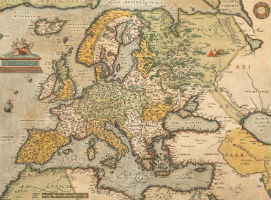
An appropriate starting point is an Abraham Ortelius map of Europe, published in Antwerp in 1584 (the first edition was published in 1570). A ship sails in the stipple engraved ocean below the title cartouche, which features Europa riding a bull. The hand-colored, copperplate engraving (above) is rated in “very good” condition” and estimated at $1,100-$1,250.
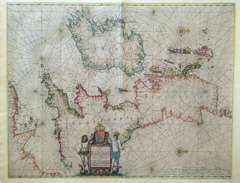
Published in Amsterdam in 1660 is J. Janssonius’ sea chart of the British Isles (below), a beautifully hand-colored copperplate engraving that is expected to cruise to $1,300-$1,400.
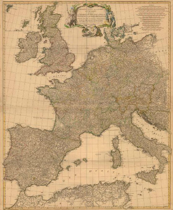
A large atlas wall map of Western Europe, published in 1756 by Jean Baptiste Bourguignon d’Anville, is printed on thick, good quality paper. Suitable for framing, the hand-colored map is estimated at $775-$875.
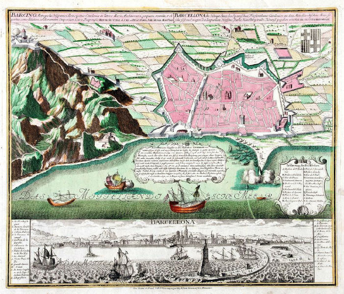
Barcelona, the great Mediterranean port city, is the subject of a plan map by Seutter of Augsburg, Germany. Dated 1740, the map contains a detailed plan of the Catalan capital in contemporary color, with an uncolored view of the city below. Both plan and view include keys to major monuments, fortifications, thoroughfares, squares and gates.
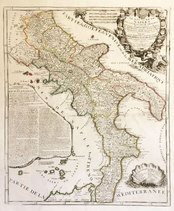
The unmistakable outline of Italy’s boot stands out in a highly detailed map of the Kingdom of Naples, published by Nolin of Paris in 1742. Dedicated to Philip V of Spain, the map includes a lengthy text block on the “Geographical and Historical Division of the Kingdom of Naples;” a letter key to symbols indicating archbishoprics, “royal fiefs,” duchies, counties, and various political and geographic features. Its superb title cartouche is held aloft by a sea monster.
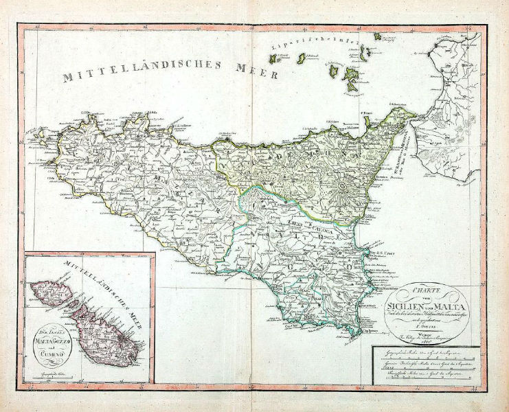
An 1801 German map of Sicily by Goetze of Weimar has an elegant title cartouche and an inset map of the Maltese Islands. The delicately colored map has a $350-$375 estimate.
This European map auction of 120 lots will begin Saturday, July 1, at 5 p.m. Eastern time.
[av_button label=’View the fully illustrated catalog and bid on LiveAuctioneers.’ link=’manually,http://bit.ly/2seURGj’ link_target=’_blank’ size=’medium’ position=’center’ icon_select=’no’ icon=’ue800′ font=’entypo-fontello’ color=’theme-color’ custom_bg=’#444444′ custom_font=’#ffffff’ admin_preview_bg=” av_uid=’av-s7r7nn’]