
NEW YORK – Grab a compass and hone in on the Premium Antiquarian Maps auction to be conducted by Jasper52 on Tuesday, March 12. This finely curated auction celebrates early cartography at its finest. Discover an antique illustrated maps and views by some of the most significant cartographers of their times, such as Ortelius, Hondius and Ruscelli. Not only will these maps serve as decorative pieces, but also reveal innumerable ways to view the world. Bid absentee or live online exclusively through LiveAuctioneers.
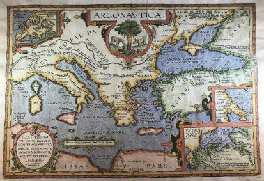
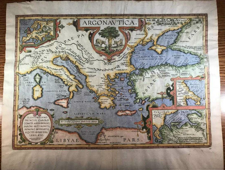
From the first modern atlas, the Theatrum Orbis Terrarum by Abraham Ortelius, is a map titled Argonautica (above), which traces the travels of Jason and the Argonauts through the ancient world. Printed in the early 1600s, the map is probably unique, potentially a proof printing. It exhibits excellent hand coloring and is a strong impression. There is no text on the back and there are no holes or staining.
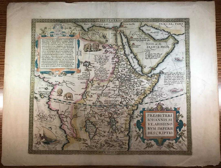
Another map originating with the Theatrum Orbis Terrarum by Ortelius is a map of Presbiteri Iohannis, the kingdom of Prester John, a fictional Christian king who was supposed to have ruled over a third of the African continent. Legend has it that Crusaders for years attempted to make contact to persuade Prester John to aid them in their holy wars. Few loose copies of this 400-year-old map remain (below). It survives in very good condition, having a few small crack holes and tears; no real staining or soiling.
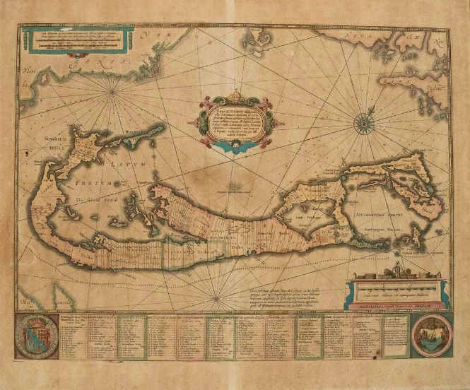
A 1633 map of Bermuda is the product of Amsterdam cartographer H. Hondius. The map is based on the landmark survey by Richard Norwood of the Bermuda Company, also known as the Somers Isles Company, in 1618. It shows the division into the original tribes throughout Bermuda, Also shown are the various landowners, with their names in a table below the map. There are many tiny houses shown on the map, showing the settlements, castles, as well as minute cannons marking the defensible points. The map is superimposed over a chart of the Atlantic with the coastlines of Britain, North America and Hispaniola showing the location of Bermuda. There is an exquisite strapwork cartouche, a coat of arms, a medallion and a compass rose.
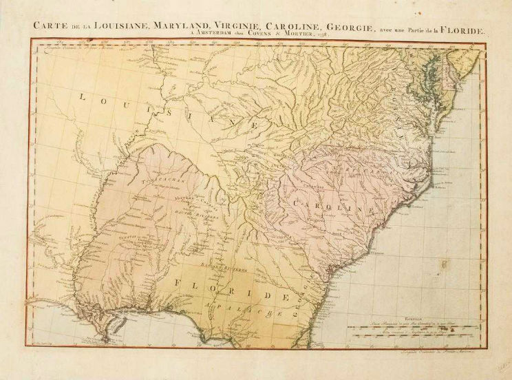
Another map published in Amsterdam is Covens and Mortier’s 1758 map of the Southeast United States from Delaware Bay to St. Augustine and New Orleans. French Louisiane occupies the country west of the Appalachians and the conflicting claims of Britain and Spain are shown in the region of Georgia and Florida. Much topographical, river, lake, settlement detail is offered including Indian villages are located throughout the map. The map was engraved by Jan Christian Sepp.
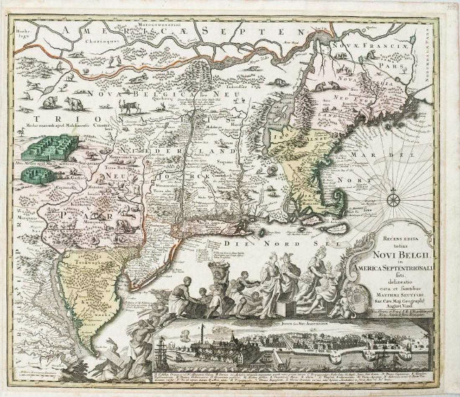
German cartographer M. Seutter’s 1730 map of New England to Virginia shows plenty of detail as to settlements, topography, native animals and of course Native American tribes and several fortified villages. This magnificent and highly influential map isn’t quite perfect: Lacus Irocoisiensis (Lake Champlain) is misplaced to the east of the Connecticut River, the St. Lawrence River and Ottawa River are intertwined, and the coast of New England is still imperfectly mapped. Toward the cartouche is a long procession of natives carry American goods to the English monarch, presumably George II, who is being attended by Hermes, Athena and Hera.
John Speed’s map of the British Isles, published in. London circa 1611, offers plenty of topographical, river, lake and settlement detail. The upper part of the map is flanked by views of London and Edinburgh, and an inset map of the Orkneys. The London view is circa 1600, with St. Paul’s Cathedral and the Tower on the north bank and the Globe on the south, with the prominently shown bridge. The map was engraved by J. Hondius for issue in Speed’s Theatre of the Empire of Great Britain. English text is printed on verso.

This Jasper52 online auction of Premium Antiquarian Maps, which consists of 112 lots, will be held Tuesday, March 12, beginning at 8 p.m. Eastern Time.
[av_button label=’View the fully illustrated catalog and bid on LiveAuctioneers.’ link=’manually,https://www.liveauctioneers.com/catalog/137203_premium-antiquarian-maps/’ link_target=’_blank’ size=’medium’ position=’center’ label_display=” icon_select=’no’ icon=’ue800′ font=’entypo-fontello’ color=’theme-color’ custom_bg=’#444444′ custom_font=’#ffffff’ av_uid=’av-j1c4a8′ admin_preview_bg=”]