Sold2020Lyttleton, George 1810 Map of England, Scotland, Wales"An Accurate Map of England, Scotland, and Wales" Copper Engraved Map Published 1810, London for "The History of England..." by George Courtney Lyttleton. Folds as issued. Paper Size: 18 x 14 inch (46See Sold Price
Sold2020Lyttleton, George 1810 Map of England, Scotland, Wales"An Accurate Map of England, Scotland, and Wales" Copper Engraved Map Published 1810, London for "The History of England..." by George Courtney Lyttleton. Folds as issued. Paper Size: 18 x 14 inch (46See Sold Price
Sold2019Lyttleton, George 1810 Map of England, Scotland, Wales"An Accurate Map of England, Scotland, and Wales" Copper Engraved Map Published 1810, London for "The History of England..." by George Courtney Lyttleton. Folds as issued. Paper Size: 18 x 14 inch (46See Sold Price
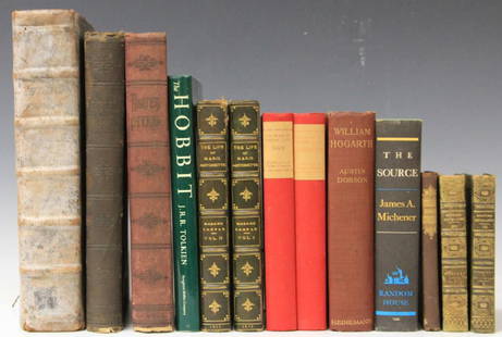
Sold2017LOT OF (13) VINTAGE NOVELS, INCLUDING OLD ENGLISHDante's Inferno, The Life of Marie Antoinette, an Old English book (title is worn off of spine) about History of England, Scotland, Wales and CornwallSee Sold Price
Sold20171835 Bradford Map of British IslandsClean hand-colored 1835 map of the British Islands by the important American mapmaker T. G. Bradford. It includes England, Scotland, Wales and Ireland and covers from the southern tip of the ShetlandSee Sold Price
Sold2022British Transport RR Police BadgeThis is a police badge for British Transport, which is the special national police force that protects the railway network of England, Scotland, and Wales. Excellent badge in like-new condition, whichSee Sold Price
Sold2024Speed, John England, Wales & Scotland and Ireland Described and AbridgedEngland, Wales & Scotland and Ireland Described and Abridged With ye historic relation of thingsworthy from a farr larger volume. [date unclear.] Small oblong 8vo, engraved title-page, 43 maps only (oSee Sold Price
Sold20181814 ATLAS Maps of England & Wales Scotland Color Nav1814 ATLAS Maps of England & Wales Scotland Color Navigation Travel John Cary An incredible atlas consisting of 42 color maps of Great Britain by John Cary. The atlas covers cities in England, Wales,See Sold Price
Sold2017British Isles: C England Wales Scotland Ireland MapBritish Isles: Counties. England Wales Scotland Ireland. Tallis/rapkin 1851 Map. Vignettes: London; Edinburgh; Dublin. Approx 36.5 x 26.5cm, 14.5 x 10.25 inches (Large). Antique engraved map by J RapkSee Sold Price
Sold2019Walker, John 1795 Pair Maps of Scotland, England, WalesCopper Engraved Maps Published 1795, London for "Elements of Geography, and of Natural and Civil History" by John Walker. Centre fold as published. Paper Size: 10 x 8.5 inch (26 x 22cm) Minor toning aSee Sold Price
Sold2022Antique Map Print - Ireland - England - Wales - ScotlandSet of 4 Map Prints. Antique lithographic map originates from "Letts's Popular Atlas", being a series of maps delineating the whole surface of the globe, with many special and original features; and aSee Sold Price
Sold2022Britain.- Mavor (William Fordyce) British Tourists; or, Traveller's Pocket Companion throughBritain.- Mavor (William Fordyce) British Tourists; or, Traveller's Pocket Companion through England, Wales, Scotland, and Ireland, 6 vol., third edition, engraved frontispieces and hand-coloured mapsSee Sold Price
Sold20201789 Leather Set The British TouristFive volume set "The British Tourists; or Traveler' Pocket Companion, Through England, Wales, Scotland, and Ireland..", by William Mavor, printed at London for E, Newberry, 1798. Volume I with frontisSee Sold Price
Sold2022Three post card albumsThree post card albums, one containing aproximatels 157 Canadian cards, one album with 244 European cards and one album with 285 cards of England and ScotlandSee Sold Price
Sold2021Neale, John C1830 Lot of 35 British Engraved ViewsSteel Engravings Published 1824-31, London for "Views of the Seats of the Noblemen and Gentlemen in England, Wales, Scotland and Ireland" by John Preston Neale, Thomas Moule and others. Paper Size: 8See Sold Price
Sold20201800 The British Tourist Six Vol Set MapsThe British Tourist or Traveller's Pocket Companion Through England, Wales, Scotland, and Ireland.., by William Mavor, printed at London for E. Newberry (others) 1800. Three volumes with folding mapsSee Sold Price
Sold2017Lot of 7 Antique MapsCirca 1796 Lot of 7 Antique Maps; ??Titles: "England, Scotland, Ireland and Wales from the best Authorities" by Cyrus Harris "Hindostan or India from the best Authorities" (Doolittle, sculp.) "SwitzerSee Sold Price
Sold2018UK 1779 Hand Coloured Copper Plate of Dover, KentHand Coloured Copper Plate Published 1779 by J. Cooke, London for "The Modern Universal British Traveller or, a New, Complete, and Accurate tour Through England, Wales, Scotland, and the NeighbouringSee Sold Price
Sold2022Burlington, Charles 1779 Lot of 20 Folio British ViewsFolio Copper Plate Published 1779 by J. Cooke, London for "The Modern Universal British Traveller or, a New, Complete, and Accurate tour Through England, Wales, Scotland, and the Neighbouring Islands"See Sold Price
Sold2023Map: An 18thC engraved map titled Angliae Scotiae et Hiberniae Regna cum insulis adjacentibus,Map: An 18thC engraved map titled Angliae Scotiae et Hiberniae Regna cum insulis adjacentibus, depicting England, Ireland, Scotland and Wales. Approx. 5 3/4" x 7"See Sold Price
Sold2021Neale, John C1830 Lot of 50 British Engraved ViewsSteel Engravings Published 1824-31, London for "Views of the Seats of the Noblemen and Gentlemen in England, Wales, Scotland and Ireland" by John Preston Neale, Thomas Moule and others. Paper Size: 8See Sold Price
Sold2019Enameled Spoons Symbols of the U.K. Sterling4 spoons in case. Appx. 3 7/8" length. England, Northern Ireland, Scotland, Wales. 1.38 Oz. Troy total weight. "Made In England", "T&S", "(Anchor)(Lion) w". (Probably Turner & Simpson).See Sold Price
Sold2022Burlington 1779 Folio British View. Deptford, LondonFolio Copper Plate Published 1779 by J. Cooke, London for "The Modern Universal British Traveller or, a New, Complete, and Accurate tour Through England, Wales, Scotland, and the Neighbouring Islands"See Sold Price
Sold2019Antique Silver Plated Horticultural ChainAntique Silver Plated Chain with England,Wales Scotland and Ireland Motifs and Flower Arrangement Medallion. Possibly a horticultural flower arrangement award chain. Length 32 inches.See Sold Price
5 days LeftFellowsGeorgian silver teapot; plus a 20th century silver bachelor teapot. (2).Preview Only
Jun 02Schilb Antiquarian Rare Books1803 King Charles II Escape from Worcester English Civil War Samuel Pepys RARE$3(3 bids)
Jun 02Schilb Antiquarian Rare Books1897 History of British Empire England Scotland Canada James II MAPS India 6v$6(4 bids)
Jun 07Freeman's | HindmanJAMES II and VII, King of England, Scotland and Ireland. Autograph letter signed as an uncle to$750
Jun 18DOYLE Auctioneers & AppraisersStereoscope with an Interesting Group of "Diableries" Stereo Cards$100
5 days LeftForum AuctionsCromwell (Oliver) Commission appointing Samuel Rose Captain Lieutenant in Sir William Constable's£2,400
Jun 07Freeman's | HindmanMURCHISON, Roderick Impey, Sir. The Silurian System. 1839. COMPLETE WITH VERY RARE HAND-COLORED$1,500
Jun 08TimeLine Auctions Ltd.Commemorative Medals - Anne - Union of England and Scotland - Bronze Medallion by Croker£5
5 days LeftForum AuctionsIreland.- James VI & I (King).- Edgeworth (Francis) Charter, grant to William Colley of land in£300
Jun 23Schilb Antiquarian Rare Books1879 Ulysses S Grant World Voyage INDIA Mughal Taj Mahal Illustrated Singapore$1
10 hrs LeftSouth Florida Auction & Estate Sale Services IncLot of 2 Error FUCK FACE Billy Ripken RP Baseball Cards$60(6 bids)
Jun 02Schilb Antiquarian Rare Books1797 Polwhele DEVONSHIRE Devon England Exeter Archbishops South Wales HUGE FOLIO$3(3 bids)


![Speed, John England, Wales & Scotland and Ireland Described and Abridged: England, Wales & Scotland and Ireland Described and Abridged With ye historic relation of thingsworthy from a farr larger volume. [date unclear.] Small oblong 8vo, engraved title-page, 43 maps only (o](https://p1.liveauctioneers.com/94/316498/169880617_1_x.jpg?height=310&quality=70&version=1705579068)


![[LANTERN SLIDES] BRIDGES etc. LOT OF 40 TOGETHER (1 of 2)](https://p1.liveauctioneers.com/8124/329803/177770634_1_x.jpg?height=282&quality=70&version=1715634941)
