Sold20211602 Ortelius Map of Normandy France -- NormandiaTitle: 1602 Ortelius Map of Normandy France -- Normandia Cartographer: A Ortelius Year / Place: 1602, Antwerp Map Dimension (in.): 3 X 4.1 in. This is a handsome smaller map of Normandy, France. The cSee Sold Price
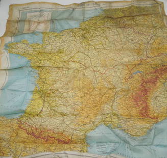
Sold2023WWII March 1944 Zones of France Silk Escape MapMarch 1944 Original silk escape map of France. This would be the type of item carried by US Paratroopers during the Invasion of Normandy, as well as US aviators flying missions over France.See Sold Price
Sold2021ROBERT CAPA - Omaha Beach, Normandy, France: D-Day,Artist: Robert Capa (Hungarian, 1913-1954). Title: "Omaha Beach, Normandy, France: D-Day, June 6, 1944 ["The Face in the Surf"] [medium format]". Medium: Original photogravure. Date: Composed 1944. PrSee Sold Price
Sold2021Provincial Wedding Armoire from Normandy, FranceFrench Provencal wedding armoire, from Normandy, FRA, two doors open to hanging compartment and shelved interior, above three drawers, carved accents 79.5 x 63 x 21.5" We happily provide seamless shSee Sold Price
Sold2021ROBERT CAPA - Omaha Beach, Normandy, France: D-Day,Artist: Robert Capa (Hungarian, 1913-1954). Title: "Omaha Beach, Normandy, France: D-Day, June 6, 1944 ["The Face in the Surf"] [medium format]". Medium: Original photogravure. Date: Composed 1944. PrSee Sold Price
Sold2016[Wall map] FranceCarte de la France, 1790.Incisione in coloritura coeva, 1200x1160 mm.See Sold Price
Sold2017Mexico sive N. Hispania Duval MapMexico sive N. Hispania. Pierre Duval (1618–1683). Engraved map with original hand color. Nuremberg, 1679. 5 x 5 1/2 inches sheet, 14 1/2 x 15 inches framedSee Sold Price
Sold2023Duval - Map of England or Great BritainThis fascinating map is from Pierre Duval. It was part of a composite or collector's atlas of his maps. It was done in Paris circa 1670s. The composite atlas originally included maps from the followinSee Sold Price
Sold2023Duval - Map of Mexico & New Spain or Central AmericaThis fascinating map is from Pierre Duval. It was part of a composite or collector's atlas of his maps. It was done in Paris circa 1670s. The composite atlas originally included maps from the followinSee Sold Price
Sold2021Jean Jolivet Map, FranceGalliae Regni Potentiss", hand colored engraving by Jean Olivet, with text verso. Toning, spotting, tears, pencil marks at the lower right, other wear. 18.5" x 23See Sold Price
Sold2023Duval - Map of Southeast Europe (Hungary, Transylvania, Bulgaria, Bosnia)This fascinating map is from Pierre Duval. It was part of a composite or collector's atlas of his maps. It was done in Paris circa 1670s. The composite atlas originally included maps from the followinSee Sold Price
Sold2023Duval - Map of IcelandThis fascinating map is from Pierre Duval. It was part of a composite or collector's atlas of his maps. It was done in Paris circa 1670s. The composite atlas originally included maps from the followinSee Sold Price
Sold2023Duval - Map of Rome, ItalyThis fascinating map is from Pierre Duval. It was part of a composite or collector's atlas of his maps. It was done in Paris circa 1670s. The composite atlas originally included maps from the followinSee Sold Price
Sold20181653 DuVal Map of Upper Egypt -- Aegyptus AntiquaTitle/Content of Map: 1653 DuVal Map of Upper Egypt -- Aegyptus Antiqua Divisa in Nomos1653 c. Amsterdam Cartographer: P DuVal Size: 14.8 x 20.5 in. This is an uncommon map of Upper Egypt and part ofSee Sold Price
Sold2024Antique Europe Map/ France. Pieced down in sections. Sight size 26-1/2 x 36 inches. Overall framedAntique Europe Map/ France. Pieced down in sections. Sight size 26-1/2 x 36 inches. Overall framed size is 32 x 42 inchesSee Sold Price
Sold2023HENRI LACOUTURE (French, 20th Century). Pair: View of Honfleur Harbor, Normandy, France, Pair ofHENRI LACOUTURE (French, 20th Century). Pair: View of Honfleur Harbor, Normandy, France, Pair of watercolors on paper. Signed and titled lower left hand corner. Individually framed. Not examined out oSee Sold Price
Sold2019Gallia Color Map [France]Galliae Regni Potentiss Color Map with written description in Latin on verso. Map of France with boarders to Germany, Spain and Italy. Appears to be a page from an atlas. Undated. Measures 14 in. x 20See Sold Price
Sold2024Le Treport French Watercolor Painting Normandy France July 1923Title:Le Treport Signed French Watercolor Painting Normandy France Description: Le Treport French Watercolor Painting Normandy France. Titled Le Treport, and dated July 1923, both in lower left cornerSee Sold Price
Sold2024MAP, France, ValckNorthwestern France. Valck, Normannia Ducatus, tum Superior ad Ortum, tum Inferior ad Occasum, Praefectura Generalis; in qua Distinctissime Exhibentur ejus Archiepiscopatus Rothomagensis..., 1700 (cirSee Sold Price
Sold2022NORMANDY FRANCE TRAVEL POSTERFrench travel poster 'Du Treport au Havre - Les Falaises et les plages de Normandie' - 'From Treport to Le Havre - The cliffs and beaches of Normandy - France', published by and for the French GovernmSee Sold Price
Sold2024MAP, France, HomannWestern France. Johann Baptist Homann, Tabula Ducatus Britanniae Gallis le Gouvernemt. General de Bretagne in suos Novem Episcopatus..., 1720 (circa). Hand Color. Large and very detailed chart roughlySee Sold Price
Sold2023Duval - Map of the Mediterranean Sea with Surrounding borders of Europe, Asia, and AfricaThis fascinating map is from Pierre Duval. It was part of a composite or collector's atlas of his maps. It was done in Paris circa 1670s. The composite atlas originally included maps from the followinSee Sold Price
Sold2016Antique Map : France - 1802Antique Map : France - 1802 from Walker's Geography Gazette. Size : 10.25" x 8.25"See Sold Price
Sold2023Duval - Map of IndiaThis fascinating map is from Pierre Duval. It was part of a composite or collector's atlas of his maps. It was done in Paris circa 1670s. The composite atlas originally included maps from the followinSee Sold Price
Jun 06Rapid Estate Liquidators and Auction GalleryFramed Jean Pierre Debernay Stilt Sandpiper Family Print$5
3 days LeftJasper52Large Antique French map GERMAN EMPIRE 1792 colored by POIRSON engraver Basset$170
Jun 09Worthington GalleriesAntique H/C Map EUROPE SOUS CHARLEMAGNE EN 814: EMPIRES D'OCCIDENT ET D'ORIENT$25


![ROBERT CAPA - Omaha Beach, Normandy, France: D-Day,: Artist: Robert Capa (Hungarian, 1913-1954). Title: "Omaha Beach, Normandy, France: D-Day, June 6, 1944 ["The Face in the Surf"] [medium format]". Medium: Original photogravure. Date: Composed 1944. Pr](https://p1.liveauctioneers.com/963/211926/111685510_1_x.jpg?height=310&quality=70&version=1631314021)

![ROBERT CAPA - Omaha Beach, Normandy, France: D-Day,: Artist: Robert Capa (Hungarian, 1913-1954). Title: "Omaha Beach, Normandy, France: D-Day, June 6, 1944 ["The Face in the Surf"] [medium format]". Medium: Original photogravure. Date: Composed 1944. Pr](https://p1.liveauctioneers.com/963/193825/104873496_1_x.jpg?height=310&quality=70&version=1622845250)
![[Wall map] France: Carte de la France, 1790.Incisione in coloritura coeva, 1200x1160 mm.](https://p1.liveauctioneers.com/3336/90951/46934974_1_x.jpg?height=310&quality=70&version=1473763184)


![Gallia Color Map [France]: Galliae Regni Potentiss Color Map with written description in Latin on verso. Map of France with boarders to Germany, Spain and Italy. Appears to be a page from an atlas. Undated. Measures 14 in. x 20](https://p1.liveauctioneers.com/5755/154409/77936853_1_x.jpg?height=310&quality=70&version=1573094011)


