Sold2018Sidney Hall: Antique Map Cronstadt & Kotlin Island 1856Title/Content of Map: 'Cronstadt [inset: Environs of St Petersburg]' Kotlin Island Peterhof Date Printed: 1856 Image Size: Approx 27.0 x 22.5cm, 10.75 x 8.75 inches (Medium) Type: Antique atlas map CoSee Sold Price
Sold2019La Svezia divisa ne'suoi Regni. Sweden & Finland.TITLE/CONTENT OF MAP: 'La Svezia divisa ne'suoi Regni di nuova projezione' Sweden divided in its Kingdoms, including Finland. The Baltic Sea and the Gulfs of Finland and Bothnia DATE PRINTED: PublisheSee Sold Price
Sold2018Bellin: Antique Map Gulf of Mexico & West Indies, 1754Title/Content of Map: Carte du Golphe de Mexique et des Isles de l'Amerique Cartographer: Jacques Bellin Place & Date: Paris / 1754/1760 Size: 14 3/4" x 10 3/4" Condition: b&w; old folds as published;See Sold Price
Sold2018MAPS: Seutter 1730 Novus Orbis sive AmericaMAPS: Seutter 1730 Novus Orbis sive America, Novus Orbis sive America Meridionalis et Septentrionalis per sua Regna Provincias et Insulas juxta observationes et descriptiones recentiss. divisa et adorSee Sold Price
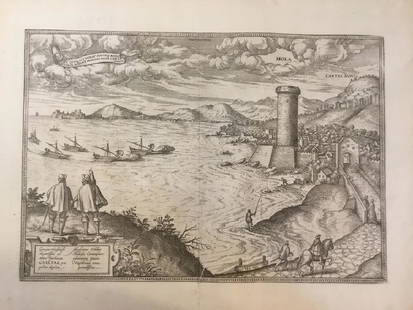
Sold2018Gulf of Gaeta (One of the oldest towns in Italy).Title/Content of Map: Gulf of Gaeta (One of the oldest towns in Italy). Date: 1572-1617 Size: 20 1/2 x16” from civitates Orbis Terrarum by Braun & Hogenberg , Cologne. Please note that this lot hasSee Sold Price
Sold2022Gulf Tourgide Service road map display with maps & clipboard9" x 18" x 5"d Gulf road map display with maps & Gulf clipboard showing normal wear. *PLEASE NOTE, THERE IS ONLY ONE WAY TO PAY FOR ONLINE ITEMS IN THIS AUCTION WHICH IS THROUGH LIVE AUCTIONEERS. THISSee Sold Price
Sold2021c 1730 Seutter Map: Novi Belgii, in America ...Historic Maps c. 1730 Historic Rare Earlier State of Seutter's Important American Northeast Map & New York City Restitutio View c. 1730 Hand-Colored Copper-Engraved Map titled, "Recens Edita totius NoSee Sold Price
Sold20181730 Seutter Map of New England to Virginia -- RecensTitle/Content of Map: 1730 Seutter Map of New England to Virginia -- Recens Edita totius Novi Belgii, in America Septentrionali siti, delineatio cura et Sumtibus Date: 1730, Nurnberg Cartographer: M SSee Sold Price
Sold2023Seutter - Map of North America including Great Lakes, Florida, Virginia, New England, Mexico, WestThis engraving is from a composite atlas presented by the Homann Heirs. Many of the maps in the collection were completed by J. B. Homann, Homann Erben, M. Seutter, and T. C. Lotter. The maps were oriSee Sold Price
Sold20181740 Seutter Map of Japan -- Imperium Japonicum perTitle/Content of Map: 1740 Seutter Map of Japan -- Imperium Japonicum per Sexaginta et Sex Regiones Digestum atque ex Ipsorum Japonensium Mappis Descriptum … Date: 1740 c., Augsburg Cartographer: MSee Sold Price
Sold20191730 Seutter Map of New England to Virginia -- RecensTitle: 1730 Seutter Map of New England to Virginia -- Recens Edita totius Novi Belgii, in America Septentrionali siti, delineatio cura et Sumtibus Date: 1730, Nurnberg Cartographer: M Seutter Size: 19See Sold Price
Sold2023Gulf Map and Tourgide Service w/Logo Metal Map Display (TAC)rated 8.5, 14"x18"x3.5", metal map display has very good color and shine, display panel is clean, has wear around the perimeter, comes with 10 Gulf road maps. TAC #046567See Sold Price
Sold20221730 SEUTTER MAP NOVI BELGII IN AMERICA1730 Historic Rare Earlier State of Seutter's Important American Northeast. Hand-Colored Copper-Engraved Map titled, "Recens Edita totius Novi Belgii, in AmericaSeptentrionali siti, delineatio cura etSee Sold Price
Sold2021Matthäus Seutter, Map of New England, c. 1730Property from a Private Collection, Hilton Head Island, SC Description: Matthäus Seutter (German/ Augsburg, 1678–1756/57) Map of New England, c. 1730, an updated view of New Netherlands inSee Sold Price
Sold2020Michael Kenna, December Thaw, Gulf of FinlandMichael Kenna (British/American, b. 1953). December Thaw, Gulf of Finland, Russia, 1999. Silver gelatin print. Signed and dated lower right and numbered '18/45' lower left in pencil on the mount. MeasSee Sold Price
Sold2020GEORG M. SEUTTER, MAP OF NORTHEAST AMERICA, LATERGeorg Matthaus Seutter (German, 1678-1757), second state, later impression. "Recens Edita totius Novi Belgii, in America Septentrionali siti, delineatio cura et sumtibus Matthaei Seutteri, Sac. Caes.See Sold Price
Sold2023seutter Map, Novus Orbis sive AmericaSEUTTER, Georg Matthaus (1678-1757). Novus Orbis sive America Meridionalis et Septentrionalis... Engraved map with original hand color. Nuremberg, c. 1740. 19 5/8" x 22 3/4" sheet. This striking map oSee Sold Price
Sold2023Matthaus Seutter Map of North AmericaColored engraving map of eastern North America by Matthaus Seutter (1678-1757). Framed; framing partially obscures borders. Map covers Eastern and Central United States and Canada, Northern Mexico, anSee Sold Price
Sold2017Depot de la Marine: Antique Map of Gulf of Mexico, 1800Map: Carte des Côtes du Golfe du Mexique Cartographer: Collin/Besançon/Dépôt Général de la Marine/ Place & Date: Paris / 1800 (Year IX) Size: 35 5/8" x 23 3/4" Condition: b&w; a beautifully presSee Sold Price
Sold2016Seutter map of Southeast AsiaHeading: Author: Seutter, Matthew Title: India Orientalis cum Adjacentibus Insulis Nova Delineatione ob oculos posita Place Published: Augsburg Publisher: Date Published: [c.1745] DescSee Sold Price
Sold2017Bellin: Antique Map of Gulf of Mexico & Caribbean, 1749Map: Carte Reduite du Golphe du Mexique et des Isles de l'Amerique Cartographer: Bellin Place & Date: Paris / 1749 Size: 32 1/4" x 21 1/8" Condition: outline color (cartouche uncolored); water stainsSee Sold Price
Sold2020After Matthaeus Seutter Map of North AmericaAfter Matthaeus Seutter (1678-1757) colored engraving map of North America. Dimensions: Sight; height: 18 1/2 in x width: 21 1/2 in. Framed; height: 25 1/4 in x width: 28 in. SKU: 03585See Sold Price
Sold2022Large detailed map of Gulf of Venice, 1693Heading: Author: Jaillot, Alexis-Hubert Title: Le Golfe De Venise, Avec ses Principaux Caps, Promontoires, & Ports de Mer Place Published: Paris Publisher: Date Published: 1793 DescripSee Sold Price
Sold2018Map Matth Seutter 1730 Novus Orbis Sive AmericaMap Matth Seutter (1676-1757). Copper engraving hand colored, map measures approximately 24" L x 20.25" H w/frame approximately 27" W x 23.5" H. Condition: Good, some foxing and center fold mark. NovuSee Sold Price
5 days LeftJasper521719 Chatelain Map of Russian Empire -- Carte Generale des Etats du Czar Empereur de Moscovie…$320
5 days LeftJasper521693 Jaillot Map of the Adriatic Sea and Much of Italy -- Le Golfe de Venise, Avec ses Principaux$500
Jun 08Early American History Auctions1853 Map of Portion of British North America and Gulf of St. Lawrence, by Henry Perley$260
5 days LeftJasper521770 French engraving map of Bonne,Rigobert Arabie. Mer Rouge et Golfe Persique$95
Jun 07Freeman's | Hindman[MAPS]. HOMANN, Johann Baptist, HOMANN HEIRS, and Georg Matthäus SEUTTER. [Composite Atlas].$15,000
1 day LeftTrillium Antique Prints & Rare BooksPrevost - Chart of the Gulf of Mexico (with Florida & Lousiana)$50(1 bid)
5 days LeftThe Bidder AuctionsAll the Russias by Henry Norman, illustr., 1st ed., 1902, in English$25
5 days LeftCedarburg Auction & Appraisals LLCSet of Four Maps Showing All of Spain and Portugal$375(2 bids)
Jun 07Freeman's | Hindman[MAP]. TODESCHI, Pietro. [Nova et Acurata Totius Americae Tabula auct. G.I. Blaeu] America quarta$5,000
5 days LeftCedarburg Auction & Appraisals LLCRare 1877 Double sided map of Milwaukee and Wisconsin$45(5 bids)
Jun 06Akiba GalleriesHoward Finster (American, 1916-2001) "Desert Storm War In Gulf" Mixed Media$150(4 bids)


![Sidney Hall: Antique Map Cronstadt & Kotlin Island 1856: Title/Content of Map: 'Cronstadt [inset: Environs of St Petersburg]' Kotlin Island Peterhof Date Printed: 1856 Image Size: Approx 27.0 x 22.5cm, 10.75 x 8.75 inches (Medium) Type: Antique atlas map Co](https://p1.liveauctioneers.com/5584/115413/59308629_1_x.jpg?height=310&quality=70&version=1516757305)


![Seutter map of Southeast Asia: Heading: Author: Seutter, Matthew Title: India Orientalis cum Adjacentibus Insulis Nova Delineatione ob oculos posita Place Published: Augsburg Publisher: Date Published: [c.1745] Desc](https://p1.liveauctioneers.com/642/86438/44449722_1_x.jpg?height=310&quality=70&version=1458591928)


![[MAPS]. HOMANN, Johann Baptist, HOMANN HEIRS, and Georg Matthäus SEUTTER. [Composite Atlas]. (1 of 5)](https://p1.liveauctioneers.com/197/329395/177650530_1_x.jpg?height=282&quality=70&version=1715364962)


![[MAP]. TODESCHI, Pietro. [Nova et Acurata Totius Americae Tabula auct. G.I. Blaeu] America quarta (1 of 1)](https://p1.liveauctioneers.com/197/329395/177650542_1_x.jpg?height=282&quality=70&version=1715364962)


