Sold2021Large Matted and Framed Map of Norfolk Virginia:Large Matted and Framed Map of Norfolk Virginia: Stylized Blazon Coat of Arms of Howard Duke of Norfolk (Premier Duke of England) Motto is "Virtuecont Alone is Invincible". Labeled JH DINGEE, Banker,See Sold Price
Sold2017Antique Framed English Map of WarwickshireAntique Framed English Map of Warwickshire, England. Framed and matted. Hand colored engraving. Measures 13.5 x 10.25 inches.See Sold Price
Sold2020FRAMED EMBROIDERY MAP OF ENGLANDsigned and dated "Sarah Boyten 1829", with floral border Condition: discoloration to linen fabric. Framed and matted under glass. 16 1/2 x 13 inches sight; 20 1/2 x 17 inches frameSee Sold Price
Sold2020Framed Saxton's Map of England & WalesFramed Saxton's Map of England & Wales. Printed by Taylowe Limited, 1966. Profesionally matted and framed. Frame measures 23 inches x 26.5 inches.See Sold Price
Sold2017The USA Map 1829, Engraving by W. Darton, London, UKThe United States of America, 1829 by W. Darton Junior, Holborn Hill. England. Hand colored engraved atlas map. Relief is shown pictorially. Map framed, matted and glazed. Publisher 1829, William DartSee Sold Price
Sold20201822 Map of Middlesex, England1822 map of Middlesex engraved by Pickett and printed for C. Smith, No. 172Strand, 1822. Matted and framed under glass. Sight image measures approximately 8-1/4” in height by 9-3/4” in widSee Sold Price
Sold2021Antique Framed Map of England / Germanic SeaAntique Framed Map of England / Germanic Sea. Circa late 17th Century & early 18th Century. Featuring "De Noort Zee" & "T Canaal". Map measures 23 inches high x 19.25 inches wide, framed measures 28.5See Sold Price
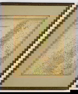
Sold2020Antique Picot & Co map of England and WalesAntique Picot & Co framed map of England and Wales with part of Scotland. Overall size 37"h x 31"w overall. Paper sight size 27 1/2"h x 21 1/4"w. Published by Picot & Co London and Manchester.See Sold Price
Sold2019Framed Map of Southern & Northern British IndiaFramed Map of Southern & Northern British India. Professionally matted and framed map depicting southern and northern British India. Frame measures 28.5 inches x 59 inches.See Sold Price
Sold20211803 FRAMED SILK MAP OF ENGLAND AND WALES, SILK1803 FRAMED SILK MAP OF ENGLAND AND WALES, SILK EMBROIDERY, JANE MARTIN MOUNTMELIOC BOARDING SCHOOL DATED AD 1803, 23 X 26See Sold Price
Sold2019Framed Map of Yorkshire, EnglandEast Riding Division, home of Thomas Tenney before migrating to New England. Map makers: Christopher Saxton, Surveyor and Cartographer; William Kip, Engraver and Printer. [Map: 7 x 9 inches; Frame: 14See Sold Price
Sold20171846 Mitchell hand-colored map of North CarolinaFeatures an inset of the Gold Region. Clean and highly collectible map of the Tar Heel state. When matted and framed this map will become a lovely, cherished specimen of wall art that is actually a piSee Sold Price
Sold2018Framed & Matted Vintage Map Of The BermudasAntique Map Of The Bermudas, this colored map is professionally framed and matter in a black with gold detailed frame with maroon matting, it is measured at 27.5 x 23 inchesSee Sold Price
Sold2017GROUP OF 3 MATTED FRAMED 19TH CENT. FRENCH MAPSA grouping of three like matted and framed nineteenth century French maps circa 1890. Ht: 24.25" Wd: 18.25"See Sold Price
Sold2024WILLIAM HENRY HUNT WATERCOLORWilliam Henry Hunt (1790-1864, England) framed and matted pencil and watercolor titled "A Lady Drawing at a Desk" with a W.S. Fine Art Ltd., London gallery label. 17.25" x 5" ss / 13.5" x 10.5" oaSee Sold Price
Sold2024WILLIAM HENRY HUNT WATERCOLORWilliam Henry Hunt (1790-1864, England) framed and matted pencil and watercolor titled "A Lady Artist", with Martyn Gregory Gallery, London label. 6" x 4.25" ss / 13.5" x 10.5" oaSee Sold Price
Sold2024JOHN WHITE ABBOTT PEN & INKJohn White Abbott (1763-1851, England) framed and matted pencil/pen/ink and grey wash titled "The Interior of a Derelict Church" with Agnew's Gallery, London label. 9" x 5" ss / 16.5" x 12.75" oaSee Sold Price
Sold2020Nantucket Map, c. 1890Two U.S. geological survey topographical chart maps framed and matted together, showing Nantucket Tuckernuck and Muskeget,c.1890, Overall, 35” x 45”See Sold Price
Sold2024TWO WILLIAM PAYNE WATERCOLORSTwo William Payne (1760-1830, England) framed and matted watercolors with pen and ink, one of a river scene landscape, the other of a woman sewing with her family beside her titled "The Fisherman's FaSee Sold Price
Sold201820 Various Photographs of Civil War Battlefields, Forts20 Various Photographs of Civil War Battlefields, Forts and Ruins. All are identified and from New England. Framed and matted, 29-1/2"h. x 34-3/4"w. overall. Condition: Good with toning.See Sold Price
Sold202218th & 19th C. MAPS OF ASIA (3 MAPS)Includes: 2 maps by John Tallis & Co. London / New York, ca. 1850, both matted and framed, including: (1) MAP OF ASIA. Hand colored engraved map. 5 hand colored vignettes. H. 10.25", W. 12.75"; (2) MASee Sold Price
Sold2024WILLIAM PAYNE WATERCOLORWilliam Payne (1760-1830, England) framed and matted watercolor of a river landscape with figures with a Fry Gallery, London label. 4.25" x 9" ss / 12" x 17" oaSee Sold Price
Jun 08Early American History Auctions1753 Map of the County of Lancaster Divided into its Hundreds, by Royal Mapmaker Emanuel Bowen$280
Jun 07Freeman's | Hindman[MAP]. ORTELIUS, Abraham. Peregrinationis Divi Pauli Typus Corographicus. 1592.$150(1 bid)
Jun 07Freeman's | Hindman[MAP]. ORTELIUS, Abraham. Presbiteri Iohannis, sive, Abissinorum Imperii Descriptio. 1592.$200
Jul 11Dan Morphy AuctionsRARE INDEPENDENT GASOLINE & MOTOR OIL FRAMED GRAPHIC HIGHWAY MAP OF ILLINOIS.$125
Jun 08Early American History Auctionsc 1730 Hand-Colored Colonial Era Map of the Americas, California shown as an Island, Matted + Framed$500(1 bid)
Jun 07Freeman's | HindmanBELLIN, Jacques-Nicolas. Carte Reduite de L'Ocean Oriental ou Mer Des Indies. Paris, 1757. Second$150
2 days LeftJasper521850’s English Fox Hunting Classic Countryside Scene Huntsman on Horseback$1,000
Jun 09Worthington Galleries19th c. English Hand-colored Engraving, John Barlow, THE PARK HOUSE NEAR FOLKESTONE$25
Jun 08Early American History Auctions1836 Hand-Colored Map, Country Twenty Five Miles Round The City Of New-York Published by D.S. Stone$260
Jun 04Mark Louis Weseloh Estate LiquidationsSix - 17th c. Maps of Europe, Asia, England, Germany x2, Crete, Greece.8 1/4" x 6 5/8".$300
Jun 08Early American History Auctions1776 Map, PARTIE ORIENTALE DU CANADA, AVEC LA NOUVELLE ANGLETERRE, L'ACADIE... by P. Santini, Framed$950
Jun 07Freeman's | Hindman[MAPS]. ORTELIUS, Abraham. A group of 3 engraved maps with hand-coloring.$175(2 bids)


![[MAP]. ORTELIUS, Abraham. Turcici Imperii Descriptio.1592. (1 of 2)](https://p1.liveauctioneers.com/197/329395/177650538_1_x.jpg?height=282&quality=70&version=1715364962)
![[MAP]. ORTELIUS, Abraham. Aevi Veteris, Typus Geographicus. 1601. (1 of 3)](https://p1.liveauctioneers.com/197/329395/177650532_1_x.jpg?height=282&quality=70&version=1715364962)
![[MAP]. ORTELIUS, Abraham. Romani Imperii Imago. 1592. (1 of 2)](https://p1.liveauctioneers.com/197/329395/177650537_1_x.jpg?height=282&quality=70&version=1715364962)
![[MAP]. ORTELIUS, Abraham. Peregrinationis Divi Pauli Typus Corographicus. 1592. (1 of 2)](https://p1.liveauctioneers.com/197/329395/177650535_1_x.jpg?height=282&quality=70&version=1715364962)
![[MAP]. ORTELIUS, Abraham. Africae Tabula Nova. 1592. (1 of 2)](https://p1.liveauctioneers.com/197/329395/177650533_1_x.jpg?height=282&quality=70&version=1715364962)
![[MAP]. ORTELIUS, Abraham. Presbiteri Iohannis, sive, Abissinorum Imperii Descriptio. 1592. (1 of 2)](https://p1.liveauctioneers.com/197/329395/177650536_1_x.jpg?height=282&quality=70&version=1715364962)


![[MAPS]. ORTELIUS, Abraham. A group of 3 engraved maps with hand-coloring. (1 of 4)](https://p1.liveauctioneers.com/197/329395/177650539_1_x.jpg?height=282&quality=70&version=1715364962)
