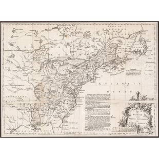
Mannevillette French Map of the Indian Ocean, 1753
Similar Sale History
View More Items in Maps & Atlases
Related Maps & Atlases
More Items in Maps & Atlases
View MoreRecommended Transportation & Travel Collectibles
View More


Item Details
Description
D'APRES DE MANNEVILLETTE, Jean-Baptiste-Nicolas-Denis (1707-1780).
[Indian Ocean] Carte Reduite de l'Ocean Oriental depuis le Cap de Bonne Esperance...
Engraved map with original hand color in part.
Paris, 1753.25 1/2" x 37 3/4" sheet.
[Untitled chart from the Horn of Africa to mouth of the Ganges].
[Indian Ocean] Carte Reduite de l'Ocean Oriental depuis le Cap de Bonne Esperance...
Engraved map with original hand color in part.
Paris, 1753.25 1/2" x 37 3/4" sheet.
[Untitled chart from the Horn of Africa to mouth of the Ganges].
Buyer's Premium
- 25%
Mannevillette French Map of the Indian Ocean, 1753
Estimate $1,000 - $2,000
Shipping & Pickup Options
Item located in New York, NY, usOffers In-House Shipping
Local Pickup Available
Payment

TOP


![[Maps] Martin Zeiler, Itinerarium Italiae, 1640: [Maps] Martin Zeiler, Itinerarium Italiae, 1640, Martini Zeilleri. Itinerarium Italiae Nov-Antiquae: oder, Raiss-Beschreibung durch Italien, Matthaus Merian, Frankfurt, 40 plates, most double-page, in](https://p1.liveauctioneers.com/188/326797/176317459_1_x.jpg?height=310&quality=70&version=1713847031)


