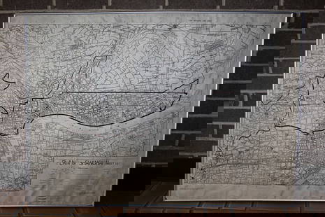
Linschoten, Delineatio orarum maritimarum 1596
Similar Sale History
View More Items in Maps & AtlasesMore Items in Maps & Atlases
View MoreRecommended Transportation & Travel Collectibles
View More


Item Details
Description
LINSCHOTEN, Jan Van (1563-1611).
Delineatio orarum maritimarum, terrae vulgo indigetatae terra do Natal.
Engraved map.
Amsterdam, 1596.
15 5/8" x 22 1/4" sheet.
Comparable: Swann Galleries, 2013 - $2,880.
Linschoten's striking map of Eastern Africa and the Indian Ocean, filled with cartographic and iconographic details, including sailing ships and sea battles, sea monsters, animals within Africa, compass roses, and a strap-work cartouche. This map shows the eastern side of Africa and part of the Indian Ocean, including Madagascar, with the extreme southern portions of present-day India and Ceylon appearing in the upper right corner.
Buyer's Premium
- 25%
Linschoten, Delineatio orarum maritimarum 1596
Estimate $5,000 - $8,000
2 bidders are watching this item.
Shipping & Pickup Options
Item located in New York, NY, usOffers In-House Shipping
Local Pickup Available
Payment

Related Searches
TOP


![Linschoten Map of South America with beautiful original: [Map - South America]. LINSCHOTEN, Jan Huygen Van (1563-1610). Delineatio omnium orarum totius Australis partis Americae... Engraved map with original hand color in full from Itinerario... Amsterdam,](https://p1.liveauctioneers.com/1968/225974/116712067_1_x.jpg?height=310&quality=70&version=1636655147)


![De Wit Holy Land Map, 1670: [Asia, Holy Land] DE WIT, Frederick (1629 ca.-1706). Terra Sancta, sive Promissionis, olim Palestina recens delineata, et in lucem edita per Fredericum De Wit. Engraved map with original hand color. A](https://p1.liveauctioneers.com/1968/225974/116712050_1_x.jpg?height=310&quality=70&version=1636655147)

![Specht View of Utrecht, Holland: SPECHT, Caspar ( fl. 1695-1740). [Utrecht, Holland] Urbis Traiecti ad Rhenum Novissima et Accuratissima Delineatio... Engraved map with original hand color. c. 1680. 21" x 25" sheet.](https://p1.liveauctioneers.com/1968/314554/168606361_1_x.jpg?height=310&quality=70&version=1704142666)

![Linschoten Map of South America, 1596: LINSCHOTEN, Jan Huygen Van (1563-1610). [South America]. Delineatio omnium orarum totius Australis partis Americae... Engraved map with original hand color in full from Itinerario... Amsterdam, 1596.](https://p1.liveauctioneers.com/1968/158667/80139424_1_x.jpg?height=310&quality=70&version=1578005088)


![[MAP]. TODESCHI, Pietro. [Nova et Acurata Totius Americae Tabula auct. G.I. Blaeu] America quarta: [MAP]. TODESCHI, Pietro. [Nova et Acurata Totius Americae Tabula auct. G.I. Blaeu] America quarta pars orbis quam plerunq, nuvum orbem appellitant primo detecta est anno 1492 a Christophoro Columbo...](https://p1.liveauctioneers.com/197/329395/177650542_1_x.jpg?height=310&quality=70&version=1715364962)


![[MAPS]. HOMANN, Johann Baptist, HOMANN HEIRS, and Georg Matthäus SEUTTER. [Composite Atlas].: [MAPS]. HOMANN, Johann Baptist (1663-1724), HOMANN HEIRS, and Georg Matthäus SEUTTER (1678-1757). [Composite Atlas]. [Nuremberg, Augsburg, and others: Homann Heirs and others, maps dated between](https://p1.liveauctioneers.com/197/329395/177650530_1_x.jpg?height=310&quality=70&version=1715364962)


![[MAP]. ORTELIUS, Abraham. Turcici Imperii Descriptio.1592.: [MAP]. ORTELIUS, Abraham (1527-1598). Turcici Imperii Descriptio. Antwerp, 1592. Engraved map with hand-coloring. Matted, framed, and double glazed, sight 406 x 521 mm (unexamined out of frame). Decor](https://p1.liveauctioneers.com/197/329395/177650538_1_x.jpg?height=310&quality=70&version=1715364962)
![[MAP]. ORTELIUS, Abraham. Americae Sive Novi Orbis, Nova Descriptio. 1573.: [MAP]. ORTELIUS, Abraham (1527-1598). Americae Sive Novi Orbis, Nova Descriptio. Antwerp, 1573. Engraved map with hand-coloring. Framed and double glazed, visible area 375 x 521 mm (unexamined out of](https://p1.liveauctioneers.com/197/329395/177650534_1_x.jpg?height=310&quality=70&version=1715364962)


