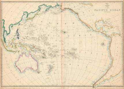
AN ANTIQUE PRINTED MAP BY E. WELLER, London c. 1860. MAP OF THE COUNTRY BETWEEN PE-KING & THE GULF
Similar Sale History
View More Items in Maps & Atlases

Related Maps & Atlases
More Items in Maps & Atlases
View MoreRecommended Transportation & Travel Collectibles
View More


Item Details
Description
AN ANTIQUE PRINTED MAP BY E. WELLER, London c. 1860. MAP OF THE COUNTRY BETWEEN PE-KING & THE GULF OF PE-CHILI. Lithograph Original outline colour. An uncommon and interesting detailed map from the area around Peking to present-day Tianjin on the coast. Clearly marked is the river system linking the two cities, adjacent canals and roads. Also indicated are temples and palaces around Beijing. Edward Weller engraved and lithographed this map for later editions of the series of maps issued as the "Weekly Dispatch" atlas. 305 by 435mm (12 by 17.25 inches).
Buyer's Premium
- 29% up to £500,000.00
- 17% above £500,000.00
AN ANTIQUE PRINTED MAP BY E. WELLER, London c. 1860. MAP OF THE COUNTRY BETWEEN PE-KING & THE GULF
Estimate £80 - £120
2 bidders are watching this item.
Shipping & Pickup Options
Item located in Bath, Somerset, ukOffers In-House Shipping
Local Pickup Available
Payment

TOP


![Amerique Méridionale'. South America. Brazil Argentina &c. BELLIN 1756 map: CAPTION PRINTED BELOW PICTURE: Amerique Méridionale [South America] DATE PRINTED: 1756 IMAGE SIZE: Approx 21.5 x 16.5cm, 8.5 x 6.5 inches (Medium) TYPE: Antique copperplate map CONDITION: Good; s](https://p1.liveauctioneers.com/5584/330116/177980523_1_x.jpg?height=310&quality=70&version=1716324705)


![Carte du Paraguay et des Pays voisins'. Uruguay Brazil. BELLIN/SCHLEY 1772 map: CAPTION PRINTED BELOW PICTURE: Carte du Paraguay et des Pays voisins [Map of Paraguay and neighbouring countries] The River Plate valley & estuary, including Uruguay, paraguay, southern Brazil, and no](https://p1.liveauctioneers.com/5584/330116/177980518_1_x.jpg?height=310&quality=70&version=1716324705)


![[MAP]. TODESCHI, Pietro. [Nova et Acurata Totius Americae Tabula auct. G.I. Blaeu] America quarta: [MAP]. TODESCHI, Pietro. [Nova et Acurata Totius Americae Tabula auct. G.I. Blaeu] America quarta pars orbis quam plerunq, nuvum orbem appellitant primo detecta est anno 1492 a Christophoro Columbo...](https://p1.liveauctioneers.com/197/329395/177650542_1_x.jpg?height=310&quality=70&version=1715364962)


![[MAPS]. HOMANN, Johann Baptist, HOMANN HEIRS, and Georg Matthäus SEUTTER. [Composite Atlas].: [MAPS]. HOMANN, Johann Baptist (1663-1724), HOMANN HEIRS, and Georg Matthäus SEUTTER (1678-1757). [Composite Atlas]. [Nuremberg, Augsburg, and others: Homann Heirs and others, maps dated between](https://p1.liveauctioneers.com/197/329395/177650530_1_x.jpg?height=310&quality=70&version=1715364962)


![[MAP]. ORTELIUS, Abraham. Turcici Imperii Descriptio.1592.: [MAP]. ORTELIUS, Abraham (1527-1598). Turcici Imperii Descriptio. Antwerp, 1592. Engraved map with hand-coloring. Matted, framed, and double glazed, sight 406 x 521 mm (unexamined out of frame). Decor](https://p1.liveauctioneers.com/197/329395/177650538_1_x.jpg?height=310&quality=70&version=1715364962)
![[MAP]. ORTELIUS, Abraham. Americae Sive Novi Orbis, Nova Descriptio. 1573.: [MAP]. ORTELIUS, Abraham (1527-1598). Americae Sive Novi Orbis, Nova Descriptio. Antwerp, 1573. Engraved map with hand-coloring. Framed and double glazed, visible area 375 x 521 mm (unexamined out of](https://p1.liveauctioneers.com/197/329395/177650534_1_x.jpg?height=310&quality=70&version=1715364962)

![[MAP]. ORTELIUS, Abraham. Aevi Veteris, Typus Geographicus. 1601.: [MAP]. ORTELIUS, Abraham (1527-1598). Aevi Veteris, Typus Geographicus. Antwerp, 1601. Engraved map with hand-coloring. Matted, framed, and double glazed, visible area 343 x 470 mm (unexamined out of](https://p1.liveauctioneers.com/197/329395/177650532_1_x.jpg?height=310&quality=70&version=1715364962)


![[FLAGS]. 31-star American parade flag. Ca 1850-1859.: [FLAGS]. 31-star American parade flag. Ca 1850-1859. 22 x 36 1/2 in. cotton flag with 31 printed stars, configured in a double medallion surrounding a much larger central star, that is haloed in both](https://p1.liveauctioneers.com/197/329785/177758218_1_x.jpg?height=310&quality=70&version=1715625218)


