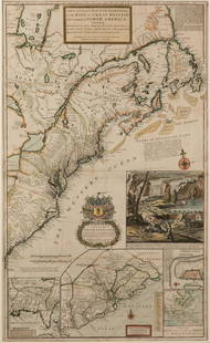
Amazon River. FRITZ – MOLL. The Great River Maranon or of the Amazons.
Similar Sale History
View More Items in Maps & AtlasesRelated Maps & Atlases
More Items in Maps & Atlases
View MoreRecommended Transportation & Travel Collectibles
View More


Item Details
Description
FRITZ, Samuel – MOLL, Herman. The Great River Maranon or of the Amazons.1711-1712.Acquaforte di 365x160 mm. Margini. Rifilata al margine sinistro. Buon esemplare.La produzione della prima mappa completa in forma manoscritta, datata 1691, dell'intero corso del Rio delle Amazzoni in Sud America è attribuita al missionario gesuita Samuel Fritz. Fritz creò la sua mappa sulla base di un viaggio presso i Jurimaguas sopra Manaus fino all'insediamento di Pará alla foce del fiume sulla costa atlantica. Nel 1689 esplorò l'Amazzonia e tracciò il corso del fiume. Padre Juan de Narvaes pubblicò una versione altamente decorata e incisa della mappa originale del Rio delle Amazzoni di Fritz nel 1707 con l'intenzione di presentarla a Filippo V. La mappa era estremamente accurata dato che si basava sull'osservazione personale e sulle informazioni di informatori nativi. La mappa di Fritz, insieme alle sue note sulla topografia, la flora e la fauna amazzoniche, continuarono ad essere l'unica fonte affidabile per i cartografi sul Rio delle Amazzoni anni dopo la sua morte nel 1724. Herman Moll riprodusse la mappa di Fritz per la sua pubblicazione del 1711-1712: “Atlas geographus: or A compleat system of geography, ancient and modern…”.
Condition
Etching of 365x160 mm. Margins. Trimmed on left margin. Good specimen.
The production of the first complete map in manuscript form, dated 1691, of the entire course of the Amazon River in South America is attributed to the Jesuit missionary Samuel Fritz.Fritz created his map based on a round-trip journey among the Jurimaguas above Manaus to the settlement at Pará at the mouth of the river on the Atlantic coast. In 1689 he explored the Amazon and charted the river's course. Father Juan de Narvaes published a highly embellished, engraved version of Fritz’s original Amazon River map in 1707 with the intention of presenting it to Philip V. The map was extremely accurate given it was based on personal observation and information from native informants. Fritz’s map, along with his notes on Amazonian topography, flora, and fauna, continued to be the only trustworthy source for cartographers about the Amazon River years after his death in 1724. Herman Moll reproduced Fritz’s map for use in his own publication projects: “Atlas geographus: or A compleat system of geography, ancient and modern…”, published in 1711-1712.
The production of the first complete map in manuscript form, dated 1691, of the entire course of the Amazon River in South America is attributed to the Jesuit missionary Samuel Fritz.Fritz created his map based on a round-trip journey among the Jurimaguas above Manaus to the settlement at Pará at the mouth of the river on the Atlantic coast. In 1689 he explored the Amazon and charted the river's course. Father Juan de Narvaes published a highly embellished, engraved version of Fritz’s original Amazon River map in 1707 with the intention of presenting it to Philip V. The map was extremely accurate given it was based on personal observation and information from native informants. Fritz’s map, along with his notes on Amazonian topography, flora, and fauna, continued to be the only trustworthy source for cartographers about the Amazon River years after his death in 1724. Herman Moll reproduced Fritz’s map for use in his own publication projects: “Atlas geographus: or A compleat system of geography, ancient and modern…”, published in 1711-1712.
Buyer's Premium
- 30%
Amazon River. FRITZ – MOLL. The Great River Maranon or of the Amazons.
Estimate €800 - €1,000
2 bidders are watching this item.
Shipping & Pickup Options
Item located in Padova, ITALY, itOffers In-House Shipping
Payment

Related Searches
TOP


![(SOUTH AMERICA -- AMAZON RIVER.) William Lewis Herndon. [Maps to Accompany Herndon's Exploration of: (SOUTH AMERICA -- AMAZON RIVER.) William Lewis Herndon. [Maps to Accompany Herndon's Exploration of the Valley of the Amazon]. 3 lithographed folding maps (one color-printed in outline). 8vo format gi](https://p1.liveauctioneers.com/199/269727/141143092_1_x.jpg?height=310&quality=70&version=1669132633)


![Public Health.- Houses of Parliament. First [-Third] Report of the Commissioners...into...Preventing: Public Health.- Houses of Parliament. First Report of the Commissioners...into...the Best Means of Preventing the Pollution of Rivers (River Thames), 2 vol., 12 maps & plans, most folding including la](https://p1.liveauctioneers.com/5458/260724/135800356_1_x.jpg?height=310&quality=70&version=1662479034)
![[MANUSCRIPT MAP-FLORIDA & MISSISSIPPI RIVER] Map Showing Raiford's Proposed Artificial River and: [MANUSCRIPT MAP-FLORIDA & MISSISSIPPI RIVER] Map Showing Raiford's Proposed Artificial River and Plan to Continue the Western and Southern Inland System of Navigation to Harbors in the Atlantic. [Fern](https://p1.liveauctioneers.com/292/250642/130213644_1_x.jpg?height=310&quality=70&version=1654271664)


![[Maps] Martin Zeiler, Itinerarium Italiae, 1640: [Maps] Martin Zeiler, Itinerarium Italiae, 1640, Martini Zeilleri. Itinerarium Italiae Nov-Antiquae: oder, Raiss-Beschreibung durch Italien, Matthaus Merian, Frankfurt, 40 plates, most double-page, in](https://p1.liveauctioneers.com/188/326797/176317459_1_x.jpg?height=310&quality=70&version=1713847031)

![[Maps] Gio. Ant. Magnini, Italia, 1620: [Maps] Gio. Ant. Magnini, Italia, 1620, Giovanni Antonio Magnini. Italia, data in luce da Fabio suo figliuolo al Serenissimo Ferdinado Gonzaga Duca di Matoua edi Monserrato etc. Bologna, for Sebastian](https://p1.liveauctioneers.com/188/326797/176317457_1_x.jpg?height=310&quality=70&version=1713847031)


