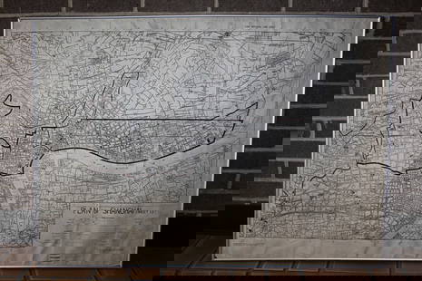
Bellin: Antique Map of Central Mexico, 1754
Similar Sale History
View More Items in Maps & AtlasesRelated Maps & Atlases
More Items in Maps & Atlases
View MoreRecommended Transportation & Travel Collectibles
View More


Item Details
Description
Framed. Original mid 18th-century French map of the Central Mexico region. This early cartographic artifact covers an area from roughly south of Durango to a line north of Acapulco. In all, a fine copperplate-engraved antique map of Mexico by N. Bellin that includes the towns of "Mazatland" (Mazatlan), "Guadalaxara" (Guadalajara), Zacatecas, Veracruz, "Mechoacan", and many more. Shows mountains in relief, many rivers, and small villages. Dated within an elaborate cartouche to 1754.
Framed, glazed, and double matted. Size with frame 18.5" x 15". Published in a French edition of L'Abbe Prevost's "Histoire Générale des Voyages". Tome 12, No. 8.
French hydrographer Jacques Nicolas Bellin (1703-1772) was born in Paris and educated as an engineer. In 1741, Bellin became the first Ingénieur de la Marine of the Depot des cartes et plans de la Marine (the French Hydrographical Office) and was named Official Hydrographer of the French King. Bellin's largest and most comprehensive work is the 'Petit Atlas Maritime' with 581 charts that cover the coasts and important port cities of the known world.
Jacques-Nicolas Bellin(1703-1772) was a French cartographer, hydrographer and geographer. Born in Paris, Bellin was a member of the French intellectual group, the philosophes, a member of the Academie de Marine and of the Royal Society of London. His career spanned over five decades in which he produced a large number of maps for the Dépot des Cartes et Plans de la Marine.
Please note that this lot has a confidential reserve. When you leave a bid in advance of the auction, submit your maximum. The bidder who has submitted the highest bid wins the lot, provided the bid exceeds the reserve price.
Shipping:
Your purchase is protected:
Photos, descriptions, and estimates were prepared with the utmost care by a fully certified expert and appraiser. All items in this sale are guaranteed authentic.
In the rare event that the item did not conform to the lot description in the sale, Jasper52 specialists are here to help. Buyers may return the item for a full refund provided you notify Jasper52 within 5 days of receiving the item.
Condition
Good. Matted and framed. Wood frame with a few nicks and scratches as shown. Engraving has NOT been examined out of frame. At sight the map appears clean, intact, and with a touch of age-toning.
Buyer's Premium
- 15%
Bellin: Antique Map of Central Mexico, 1754
Estimate $275 - $325
2 bidders are watching this item.
Get approved to bid.
Shipping & Pickup Options
Item located in South Carolina, USSee Policy for Shipping
Payment
See More Items From This Jasper52 Seller

Auction Curated By

Maps Expert
TOP


![Tabasco, Chiapa, Verapaz, Guatimala, Honduras & Yucatan' Mexico BELLIN 1754 map: CAPTION PRINTED BELOW PICTURE: Carte des Provinces de Tabasco, Chiapa, Verapaz, Guatimala, Honduras et Yucatan [Map of the provinces of Tabasco, Chiapas, Verapaz, Guatemala, Honduras and Yucatan] DATE](https://p1.liveauctioneers.com/5584/330116/177980521_1_x.jpg?height=310&quality=70&version=1716324705)


![La Partie la plus Méridionale de l’Amérique'. Patagonia. Chile. BELLIN 1753 map: CAPTION PRINTED BELOW PICTURE: Carte réduite de la Partie la plus Méridionale de l’Amérique [Map of the southernmost part of America] DATE PRINTED: 1753 IMAGE SIZE: Approx 24.0 x](https://p1.liveauctioneers.com/5584/330116/177980519_1_x.jpg?height=310&quality=70&version=1716324705)
![Carte des Provinces de Tierra Firme, Darien…' Panama Colombia. BELLIN 1756 map: CAPTION PRINTED BELOW PICTURE: Carte des Provinces de Tierra Firme, Darien, Cartagene et Nouvelle Grenade [Map of the provinces of Tierra Firme, Darien, Cartagena and New Granada] DATE PRINTED: 1756 I](https://p1.liveauctioneers.com/5584/330116/177980524_1_x.jpg?height=310&quality=70&version=1716324705)
![Cartagène, Ste. Marthe et Venezuela'. Colombia. Cartagena. BELLIN 1754 map: CAPTION PRINTED BELOW PICTURE: Carte des Provinces de Cartagène, Ste. Marthe et Venezuela [Map of Provinces of Cartagena, Santa Marta and Venezuela] DATE PRINTED: 1754 IMAGE SIZE: Approx 20.5 x 3](https://p1.liveauctioneers.com/5584/330116/177980520_1_x.jpg?height=310&quality=70&version=1716324705)
![Amerique Méridionale'. South America. Brazil Argentina &c. BELLIN 1756 map: CAPTION PRINTED BELOW PICTURE: Amerique Méridionale [South America] DATE PRINTED: 1756 IMAGE SIZE: Approx 21.5 x 16.5cm, 8.5 x 6.5 inches (Medium) TYPE: Antique copperplate map CONDITION: Good; s](https://p1.liveauctioneers.com/5584/330116/177980523_1_x.jpg?height=310&quality=70&version=1716324705)
![Carthagene des Indes'. Cartagena de Indias city plan, Colombia. BELLIN 1756 map: CAPTION PRINTED BELOW PICTURE: Plan de la Ville de Carthagene des Indes [Plan of the city of Cartagena de Indias] DATE PRINTED: 1756 IMAGE SIZE: Approx 19.5 x 33.5cm, 7.75 x 13.25 inches (Large); Plea](https://p1.liveauctioneers.com/5584/330116/177980525_1_x.jpg?height=310&quality=70&version=1716324705)


![[MAP]. TODESCHI, Pietro. [Nova et Acurata Totius Americae Tabula auct. G.I. Blaeu] America quarta: [MAP]. TODESCHI, Pietro. [Nova et Acurata Totius Americae Tabula auct. G.I. Blaeu] America quarta pars orbis quam plerunq, nuvum orbem appellitant primo detecta est anno 1492 a Christophoro Columbo...](https://p1.liveauctioneers.com/197/329395/177650542_1_x.jpg?height=310&quality=70&version=1715364962)


![[MAPS]. HOMANN, Johann Baptist, HOMANN HEIRS, and Georg Matthäus SEUTTER. [Composite Atlas].: [MAPS]. HOMANN, Johann Baptist (1663-1724), HOMANN HEIRS, and Georg Matthäus SEUTTER (1678-1757). [Composite Atlas]. [Nuremberg, Augsburg, and others: Homann Heirs and others, maps dated between](https://p1.liveauctioneers.com/197/329395/177650530_1_x.jpg?height=310&quality=70&version=1715364962)


![[MAP]. ORTELIUS, Abraham. Turcici Imperii Descriptio.1592.: [MAP]. ORTELIUS, Abraham (1527-1598). Turcici Imperii Descriptio. Antwerp, 1592. Engraved map with hand-coloring. Matted, framed, and double glazed, sight 406 x 521 mm (unexamined out of frame). Decor](https://p1.liveauctioneers.com/197/329395/177650538_1_x.jpg?height=310&quality=70&version=1715364962)
![[MAP]. ORTELIUS, Abraham. Americae Sive Novi Orbis, Nova Descriptio. 1573.: [MAP]. ORTELIUS, Abraham (1527-1598). Americae Sive Novi Orbis, Nova Descriptio. Antwerp, 1573. Engraved map with hand-coloring. Framed and double glazed, visible area 375 x 521 mm (unexamined out of](https://p1.liveauctioneers.com/197/329395/177650534_1_x.jpg?height=310&quality=70&version=1715364962)


