1814 ATLAS Maps of England & Wales Scotland Color Nav
Similar Sale History
View More Items in BooksRelated Books
More Items in Books
View MoreRecommended Books, Magazines & Papers
View More


Item Details
Description
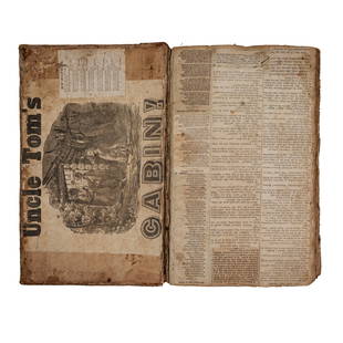
1814 ATLAS Maps of England & Wales Scotland Color Navigation Travel John Cary
An incredible atlas consisting of 42 color maps of Great Britain by John Cary. The atlas covers cities in England, Wales, and Scotland and, per the title, depicts roads, rivers, towns, parks, and other physical aspects of the British landscape. Cary gained his reputation as a cartographer for his work on globes and maps after publishing this atlas, which would become a standard reference work in England at the end of the 18th-century.
The maps from this work are often extracted and sold as individual pieces. It is quite rare to find them all in tact in one fine binding.
The general map of England and Wales is, according to the Wardington Catalogue,"…the first map on the meridian of Greenwich instead of London (St. Paul's Cathedral) which had been used on English maps from its introduction by John Seller in 1676".
Item number: #3600
Price: $750
CARY, John
Cary's Traveller's Companion; or, a Delineation of the Turnpike Roads of England and Wales; shewing the immediate Route to every Market and Boroughtown throughout the Kingdom, Laid down from the best Authorities, on a New Set of County Maps. To which is added, An Alphabetical List of all the Market Towns, with the Days on which they are held.
London. Printed for John Cary. 1814.
Details:
•Collation complete with all pages: 946p
oIncludes 42 maps (7 folding)
•Language: English
•Provenance: Bookplate – Charles Benson
•Binding: leather; tight and secure
•Size: ~7in X 5in (17.5cm x 12.5cm)
Our Guarantee:
Very Fast. Very Safe. Free Shipping Worldwide.Customer satisfaction is our priority! Notify us with 7 days of receiving, and we will offer a full refund without reservation!3600
Condition
Excellent
Buyer's Premium
- 0%
1814 ATLAS Maps of England & Wales Scotland Color Nav
Estimate $750 - $1,500
19 bidders are watching this item.
Shipping & Pickup Options
Item located in Columbia, MO, usSee Policy for Shipping
Payment

Related Searches
TOP


![1755 LITURGY OF CHURCH OF ENGLAND in ENGLISH FULLY ILLUSTRATED ANTIQUE: ?The Liturgy of the Church of England Illustrated with Fifty Nine Historical and Explanatory Sculptures ? Publish'?d according to Act of Parliament May 1st 1755 by Edw[ar]d Ryland?) Printed and sold b](https://p1.liveauctioneers.com/5584/328415/176935144_1_x.jpg?height=310&quality=70&version=1715112425)


![19 issues of rare Gay Magazine METRA 1985-1986: [Queer interest], Metra: Midwest America's Leading Free Gay Magazine, 19 issues, published 1986-1987, a few duplicates, softcover, staplebound wraps, illustrated throughout in black and white, publish](https://p1.liveauctioneers.com/184/328649/177016396_1_x.jpg?height=310&quality=70&version=1714770323)


