


1833 ATLAS MAPS Cartography Navigation Voyages
Similar Sale History
View More Items in Books


Related Books


![1799 LA PEROUSE VOYAGE antique RARE w/ MAP in DUTCH: [La Perouse, J.F.G. de] Ontdekkingen in de Zuidzee, en berichten aangaande De la Pérouse en zijne tochtgenoten, opgemaakt uit sporen van zijne reis, op onderscheidene eilanden en landen der Still](https://p1.liveauctioneers.com/5584/330217/178021049_1_x.jpg?height=310&quality=70&version=1716324705)


![1719 BIBLE DUTCH BIBLIA FOLIO w/ CLASPS & MAPS antique decorative binding: Biblia: De Gantsche H Schrifture [...] Dordrecht/Amsterdam, Pieter Keur/Piter Rotterdam, 1719 (46) 332 sheets ( 664 pages), (2) 144 sheets ( 288 pages), (26) 169 sheets ( 338 pages), (4) 58 ( 116 page](https://p1.liveauctioneers.com/5584/330217/178020904_1_x.jpg?height=310&quality=70&version=1716324705)


More Items in Books
View More


Recommended Books, Magazines & Papers
View More


Item Details
Description
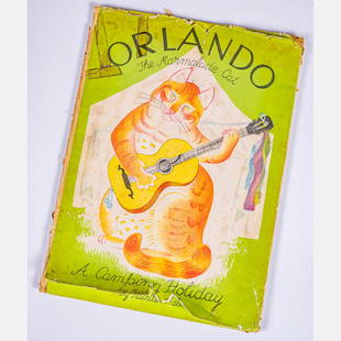
1833 ATLAS MAPS Cartography Navigation Voyages Illustrated French Petit Monin
Charles V. Monin was a 19th-century French cartographer who was one of the first Europeans to print maps under the printing process of lithographic engraving. His prints became extremely popular and were in high demand because of their beauty and attention to detail. He used steel plates in his print runs rather than the more economical copper. His two most important publications are ‘Petit National Atlas’ and ‘Universal Atlas of Geography.’
This incredible printing of ‘Petit National Atlas’ features 98 impressive maps of world countries and islands, as well as French regions and provinces, each with scenic illustrated figures. (these early volumes were thought to include 100 maps; however, actual count in Monin atlases never included exactly 100 maps, always 96-98.). Notable maps include views of Algeria, Senegal, Bourbon Island, Martinique, Newfoundland, Guyana, and many more.
Item number: #4792
Price: $499
MONIN, Charles V.
Petit atlas national des départemens de la France et de ses colonies
Paris : Blaisot, mars 1833.
Details:
Collation: Complete with all pages
98 full-page maps
Language: French
Binding: Leather; tight & secure
Size: ~10.5in X 13.25in (26.5cm x 33.5cm)
Our Guarantee:
Very Fast. Very Safe. Free Shipping Worldwide.
Customer satisfaction is our priority! Notify us with 7 days of receiving, and we will offer a full refund without reservation!
4792
Condition
Excellent.
Buyer's Premium
- 0%
1833 ATLAS MAPS Cartography Navigation Voyages
Estimate $499 - $1,000
6 bidders are watching this item.
Shipping & Pickup Options
Item located in Columbia, MO, usSee Policy for Shipping
Payment

Related Searches
TOP