


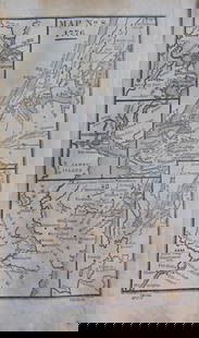
Meyer's Zeitungs-Atlas with important map of Southwest
Similar Sale History
View More Items in Maps & Atlases


![MAPS, Southwest US, Eddy/Cornely: Southwestern United States, Reno. Eddy/Cornely, [Lot of 2] Panoramic Perspective of the Area Adjacent to Boulder Dam as It Will Appear When Lake Is Filled... [and] Reno and the Truckee Meadows, 1938-4](https://p1.liveauctioneers.com/6576/239352/124055616_1_x.jpg?height=310&quality=70&version=1646166282)


Related Maps & Atlases


![[MAP]. SPEED, John. A New Mappe of the Romane Empire. 1676.: [MAP]. SPEED, John (ca 1551-1629). A New Mappe of the Romane Empire. London: Basset & Chiswell, 1676. Engraved map with hand-coloring. Framed and double glazed, sight 419 x 559 mm. Decorative cartouch](https://p1.liveauctioneers.com/197/329395/177650541_1_x.jpg?height=310&quality=70&version=1715364962)


More Items in Maps & Atlases
View More


![[MAP]. TODESCHI, Pietro. [Nova et Acurata Totius Americae Tabula auct. G.I. Blaeu] America quarta: [MAP]. TODESCHI, Pietro. [Nova et Acurata Totius Americae Tabula auct. G.I. Blaeu] America quarta pars orbis quam plerunq, nuvum orbem appellitant primo detecta est anno 1492 a Christophoro Columbo...](https://p1.liveauctioneers.com/197/329395/177650542_1_x.jpg?height=310&quality=70&version=1715364962)


![[MAP]. ORTELIUS, Abraham. Americae Sive Novi Orbis, Nova Descriptio. 1573.: [MAP]. ORTELIUS, Abraham (1527-1598). Americae Sive Novi Orbis, Nova Descriptio. Antwerp, 1573. Engraved map with hand-coloring. Framed and double glazed, visible area 375 x 521 mm (unexamined out of](https://p1.liveauctioneers.com/197/329395/177650534_1_x.jpg?height=310&quality=70&version=1715364962)
![[MAPS]. HOMANN, Johann Baptist, HOMANN HEIRS, and Georg Matthäus SEUTTER. [Composite Atlas].: [MAPS]. HOMANN, Johann Baptist (1663-1724), HOMANN HEIRS, and Georg Matthäus SEUTTER (1678-1757). [Composite Atlas]. [Nuremberg, Augsburg, and others: Homann Heirs and others, maps dated between](https://p1.liveauctioneers.com/197/329395/177650530_1_x.jpg?height=310&quality=70&version=1715364962)


![[MAP]. ORTELIUS, Abraham. Turcici Imperii Descriptio.1592.: [MAP]. ORTELIUS, Abraham (1527-1598). Turcici Imperii Descriptio. Antwerp, 1592. Engraved map with hand-coloring. Matted, framed, and double glazed, sight 406 x 521 mm (unexamined out of frame). Decor](https://p1.liveauctioneers.com/197/329395/177650538_1_x.jpg?height=310&quality=70&version=1715364962)

![[MAP]. ORTELIUS, Abraham. Aevi Veteris, Typus Geographicus. 1601.: [MAP]. ORTELIUS, Abraham (1527-1598). Aevi Veteris, Typus Geographicus. Antwerp, 1601. Engraved map with hand-coloring. Matted, framed, and double glazed, visible area 343 x 470 mm (unexamined out of](https://p1.liveauctioneers.com/197/329395/177650532_1_x.jpg?height=310&quality=70&version=1715364962)
Recommended Transportation & Travel Collectibles
View More


![[FLAGS]. 31-star American parade flag. Ca 1850-1859.: [FLAGS]. 31-star American parade flag. Ca 1850-1859. 22 x 36 1/2 in. cotton flag with 31 printed stars, configured in a double medallion surrounding a much larger central star, that is haloed in both](https://p1.liveauctioneers.com/197/329785/177758218_1_x.jpg?height=310&quality=70&version=1715625218)


Item Details
Description
Author: Meyer, Joseph
Title: Neuester Zeitungs - Atlas für Alte & Neue Erdkunde
Place Published: Hildburghausen, Amsterdam, and New-York
Publisher:Bibliographischen Instituts; Stahlstich, Druck
Date Published: [1849-52]
Description:
With 123 total steel-engraved maps and plates, plus insets; maps outlined in period hand-coloring (except 3 including London and Paris maps); 3 of the plates show celestial and navigational figures, and rivers and mountains of the world; steel-engraved title page. (Oblong 4to) 25x31.5 cm (10x12¼"), bound in period quarter red morocco and paper boards.
Includes the important map of the southwest showing California, Texas, Mew Mexico and Utah along with portions of Northern Mexico, drawn by J. Grässl in 1852 titled "Vereinigte Staaten von Nord-America: Californien, Texas und die Territorien New Mexico u. Utah," providing a fine example of precise German-style engraving of the era. Shows the California Gold Region highlighted in gold from Marysville to the lower Joaquin Valley; also, titles Fremont's 1845 route which passes through "Mormon City" [Salt Lake City]; California's boundaries not clearly marked and merges with Utah; Colorado River titled; plus several important markings and titling including "Austins Grant" in Texas, many early roads, Indian Tribal names, California Missions and Forts titled, unusual configuration for Texas and New Mexico, and a host of other details shown. Several maps cover the ancient world, 7 specifically of the United States, 27 of the German regions, 5 continents and more. Maps are all complete, most of which date between 1849 to 1850, with only a few from 1851 to 1852. See Wheat, Maps of Gold Region, 217; Wheat, Mapping Transmississippi West, 750.
Condition
Buyer's Premium
- 25%
Meyer's Zeitungs-Atlas with important map of Southwest
Shipping & Pickup Options
Item located in Berkeley, CA, usPayment
