Sold20231867 Exploration in EGYPT Holy Land Sinai Ruins Pyramids Bible Archaeology MAPS1867 Exploration in EGYPT Holy Land Sinai Ruins Pyramids Bible Archaeology MAPS The Handwriting of God is a fascinating, mid-19th-century account of the Holy Land and Egypt from the Old Testament timeSee Sold Price
Sold20231867 Handwriting of God Holy Land Exploration in EGYPT Sinai Ruins Pyramids1867 Handwriting of God Holy Land Exploration in EGYPT Sinai Ruins Pyramids The Handwriting of God is a fascinating, mid-19th-century account of the Holy Land and Egypt from the Old Testament times. ASee Sold Price
Sold20211862 Handwriting of God Exploration in EGYPT1862 Handwriting of God Exploration in EGYPT & Holy Land Sinai Ruins Pyramids ‘The Handwriting of God’ is a fascinating, mid-19th-century account of the Holy Land and Egypt from the Old TestamentSee Sold Price
Sold20211867 1ed HOLY LAND Illustrated Bible Jerusalem Egypt1867 1ed HOLY LAND Illustrated Bible Jerusalem Egypt MAP Characters & Places Charles Elliott’s “Remarkable Characters and Places of the Holy Land” is a rare historical account of Biblical historSee Sold Price
Sold20201856 Egypt & Holy Land Incidents of Travel John Stephen1856 Egypt & Holy Land Incidents of Travel John Stephens Pyramids Archaeology 2v John Stephens was an important 19th-century American explorer who is known for his published accounts of his voyages toSee Sold Price
Sold20201858 Egypt & Holy Land Incidents of Travel John Stephen1858 Egypt & Holy Land Incidents of Travel John Stephens Pyramids 2v Archaeology John Stephens was an important 19th-century American explorer who is known for his published accounts of his voyages toSee Sold Price
Sold20201886 Holy Land & Book BIBLE Illustrations MAP Damascus1886 Holy Land & Book BIBLE Illustrations MAP Damascus Lebanon Archaeology In 1859, American missionary William Thomson published a report recounting his experiences in the Middle East – ‘The LandSee Sold Price
Sold2019Wells, Edward 1817 Pair of Prints Sphinx Pyramids EgyptCopper Engraved Map Published 1817, London for "A Companion to the Holy Bible; The Sunject, Sacred Geography..." by Edward Wells. Paper Size: 10.5 x 8 inch (27 x 21cm) Good ConditionSee Sold Price
Sold2023David Roberts - The Great Sphinx, Pyramids of GizehDavid Roberts' most famous work, Views in the Holy Land, Syria, Idumea, Arabia, Egypt, & Nubia, was published by E. G. Moon in London between 1846 and 1849. This work is known for its extremely detailSee Sold Price
Sold2023David Roberts - Pyramids of GeezehDavid Roberts' most famous work, Views in the Holy Land, Syria, Idumea, Arabia, Egypt, & Nubia, was published by E. G. Moon in London between 1846 and 1849. This work is known for its extremely detailSee Sold Price
Sold2020Middle East.- Roberts (David) The Holy Land, Syria,Middle East.- Roberts (David) The Holy Land, Syria, Idumea, Arabia, Egypt, & Nubia, 6 vol. in 3, 248 tinted lithograph plates (including titles) and 2 engraved maps, occasional light foxing, corner ofSee Sold Price
Sold2022Middle East.- Roberts (David) The Holy Land, Syria,Middle East.- Roberts (David) The Holy Land, Syria, Idumea, Arabia, Egypt & Nubia, 6 vol. in 3, portrait frontispiece, 6 pictorial lithograph titles, 241 tinted lithographs, 2 maps, tissue guards, mosSee Sold Price
Sold20211747 1ed Bible History Creation Noah Flood EGYPT1747 1ed Bible History Creation Noah Flood EGYPT Cosmogony MAPS Pyramids The “Universal History” is a mid-18th-century history of the world. Written by numerous authors and contributors, this enorSee Sold Price
Sold2016c. 1670 Engraved Holy Land + Mediterranean MapHistoric Maps c. 1670 Engraved Map of the Holy Land & Mediterranean Sea c. 1670, Historic Hand-Colored Engraved Map entitled: “Terra Sancta sive Promissionis olim Palestina recens delineata,” by FSee Sold Price
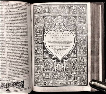
Sold20201612 King James Holy Bible, Genealogy / Map of CanonTHE HOLY BIBLE 1612 This is a very rare 1612 Quartos as there were very few produced to make ready for the 1613 Quartos.See Sold Price
Sold2021Eleven Antique Maps of EuropeEleven Antique Maps of Europe , 16th-18th c., incl. Ptolemy from 1541 (4); a Blaeu map of "Regno di Napoli", Hondius map of the Holy Land, de Wit map of Southern Spain, an undated manuscript map of MeSee Sold Price
Sold20244 Antique Maps of Various LocationsFrench Map of Canada By Guillaume Del'Isle, Map Of Asia By Guiljelmo Blaeuw, Double Hemisphere map By Nicolao Visscher, Map Of The Holy Land Jerusalem, all maps are roughly 18" x 14"See Sold Price
Sold2021Manuscript Map of the Holy Land, early 18th Century[Manuscript map of the Holy Land] Pencil, ink, and watercolor on faux vellum with horizontal and vertical folding creases (8 segments) and no mounting guard; pencil grid visible in upper left and righSee Sold Price
Sold2024De Jode, Rare, pub. 1593 - Map of the Holy Land (Descriptio Et Situs Terrae Sanctae Alio NomineThis map of the Holy Land is entitled Descriptio Et Situs Terrae Sanctae Alio Nomine Palestina Multis Preclaris Historys Et Miraculis Utriusque Testamenti A Christo Salvatore nobilitata. The map is beSee Sold Price
Sold20221651 Speed Map of the Holy Land -- Canaan. Begun by Mr. John More Continued and Finished by JohnTitle: 1651 Speed Map of the Holy Land -- Canaan. Begun by Mr. John More Continued and Finished by John Speede Cartographer: J Speed Year / Place: 1651, London Map Dimension (in.): 15.1 X 20.6 in. ThiSee Sold Price
Sold2020Abraham Ortelius: Antique Map of the Holy Landwith 22 vignettes depicting the story of Abraham 16 1/4" x 20 1/4" sheetSee Sold Price
Sold2022(HOLY LAND.) Abraham Ortelius. Terra Sancta.(HOLY LAND.) Abraham Ortelius. Terra Sancta. Double-page engraved map of the Holy Land. 16x21¼ inches sheet size, wide margins, Latin text on verso; original hand-color in full; minor toning andSee Sold Price
Sold2020ORTELIUS, ABRAHAM. Palestinae sive Totius TerraeORTELIUS, ABRAHAM. Palestinae sive Totius Terrae Promissionis Nova Descriptio. Double-page engraved map of the Holy Land. 17½x22¼ inches sheet size, wide margins, Latin text on verso; originSee Sold Price
Sold2023THREE ANTIQUE JEWISH NATIONAL FUND COLLECTION BOXES. Palestine and the United States, c. 1948. TwoTHREE ANTIQUE JEWISH NATIONAL FUND COLLECTION BOXES. Palestine and the United States, c. 1948. Two square boxes decorated with the map of the Holy land that are similar in style and one tubular shapedSee Sold Price
2 hrs LeftTrillium Antique Prints & Rare BooksDavid Roberts - The Great Sphinx, Pyramids of Gizeh$200
Jun 02Schilb Antiquarian Rare Books1871 Holy BIBLE & MAPS Holy Land Hitchcock Analysis Gruden Concordance Theology$120(3 bids)
2 hrs LeftTrillium Antique Prints & Rare BooksDavid Roberts - Front Elevation of the Great Temple of Aboosimble, Nubia$200(1 bid)
Jun 01Trillium Antique Prints & Rare BooksDavid Roberts - Grand Portico of the Temple of Philae, Nubia$200
1818 AuctioneersArchaeology. Egyptology. Naville, Edouard - The Temple of Deir El Bahari. London: Egypt£10(1 bid)
Jun 23Schilb Antiquarian Rare Books1790 Life of Jesus Christ Fleetwood Bible ART Miracles Jerusalem MAP Holy Land$42(2 bids)
Jun 23Schilb Antiquarian Rare Books1879 Ulysses S Grant World Voyage INDIA Mughal Taj Mahal Illustrated Singapore$1
2 hrs LeftTrillium Antique Prints & Rare BooksDe Jode, Rare, pub. 1593 - Map of Europe (Nova Totius Europae Tabula)$210(4 bids)


![Manuscript Map of the Holy Land, early 18th Century: [Manuscript map of the Holy Land] Pencil, ink, and watercolor on faux vellum with horizontal and vertical folding creases (8 segments) and no mounting guard; pencil grid visible in upper left and righ](https://p1.liveauctioneers.com/1968/225974/116712048_1_x.jpg?height=310&quality=70&version=1636655147)


