Sold2017Chatelain: Double Hemisphere Antique World Map, 1705Map: Mappemonde ou Description General du Globe Terrestre Cartographer: Henri Chatelain Place & Date: Amsterdam / 1705 Size: 17 1/4" x 13 1/4" Condition: wash color; overall age toning, repaired splitSee Sold Price
Sold2020Antique View and MapColossus of Rhodes. View of one of seven Wonders of Ancient World. Antique engraving. With antique double hemisphere world map, published London, 1822. Sights 10 1/2" x 16 1/2" and 7" x 9".See Sold Price
Sold2023ENGRAVED DOUBLE HEMISPHERE WORLD MAPS BY ZURNERAdam Friedrich Zurner, 1679 to 1742, two engraved double-hemisphere world map Planisphaerium Terrestre cum utroque Coelesti Hemisphaerio, sive Diversa Orbis Terraquei, colored by a contemporary hand.See Sold Price
Sold2022ENGRAVED DOUBLE HEMISPHERE WORLD MAPS BY ZURNERAdam Friedrich Zurner, 1679 to 1742, two engraved double-hemisphere world map Planisphaerium Terrestre cum utroque Coelesti Hemisphaerio, sive Diversa Orbis Terraquei, colored by a contemporary hand.See Sold Price
Sold2024Ptolemy & Magini, pub. 1620 - Double Hemisphere Map of the WorldThis early map engraving is from Claudius Ptolemaeus (Ptolemy) and Giovanni Antonio Magini's Geografia cio? Descrittione Universale della Terra Partita in due volumni, Nel Primo de' quali si contengonSee Sold Price
2022Blaeu, Johannes (Netherlands, 1596-1673) "The New World Map" Double Hemisphere World Map C. 1664Nova et Accuratissima Totius Terrarum Orbis Tabula Translated "The New World Map", Hand Colored w/ Elaborately Decorated Spandrels.   Sight View 16" x 21-1/2", Overall View 21" x 25-1/2"See Sold Price
Sold20201746 Homann Double Hemisphere World Map -- PlaniglobiiTitle/Content of Map: 1746 Homann Double Hemisphere World Map -- Planiglobii Terrestris Mappa Universalis utrumque Hemisphaerium Orient et Occidentale Repraesentans ex IV. Mappis Generalibus ... / MapSee Sold Price
Sold2021Double hemisphere world map with additionalTitle: Double hemisphere world map with additional projections. 1752 by Homann Heirs Date/Period: 1762 Materials: Copperplate engraved Size: 24 x 20 1/2 1762, by J. B. Homann & Homann Heirs, from "AtlSee Sold Price
2022Seutter, Matthaus (Germany, 1678-1757) Double Hemisphere World Map C. 1730Sight View  19-1/2" x 23", Overall View 22" x 25", Hand Colored "Quibus Addita, Pro Mutatione Horizontis Differentes Sphara Po Sitiones Earumque Convenientia Et RelaSee Sold Price
Sold2019Double hemisphere world map by Ruscelli, 1561Heading: Author: Ruscelli, Girolamo Title: Orbis Descriptio Place Published: Venice Publisher: Date Published: 1561-[1574?] Description: Double-hemisphere copper-engraved wSee Sold Price
Sold20241747 Lat Double Hemisphere World Map -- De Nieuwe en Ouden, Oppervlakke en Doorzigtkundige AardryksTitle: 1747 Lat Double Hemisphere World Map -- De Nieuwe en Ouden, Oppervlakke en Doorzigtkundige Aardryks Bollen Getekent en Uitgegeven tot Almelo by Jacobus Keizer en te Deventer by Ian De Lat CartoSee Sold Price
Sold2021Double Hemisphere world map by Bonne/ Raynal 1780Title: Double Hemisphere world map by Bonne/ Raynal 1780 Date/Period: 1780 Materials: Copperplate engraved Size: 17 1/2 x 9 3/4”. Maps shows the North American west empty, misshaped Alaska, theSee Sold Price
Sold2020Double Hemisphere World MapOverall with frame 37 1/4" high x 37" wide. IMPORTANT: Before bidding, please read the terms and conditions below. When you registered for the auction you agreed to these terms and will be required toSee Sold Price
Sold20191891 Cram Double Hemisphere World Map -- EasternTitle/Content of Map: 1891 Cram Double Hemisphere World Map -- Eastern Hemisphere; Western Hemisphere Cartographer: G CramDate: 1891, Chicago Size: 13 x 10.5 in. A very nice double page map set of theSee Sold Price
Sold2022World.- Plancius (Petrus) Orbis Terrarum Typus de Integro Multis in Locis Emendatus auctore PetroWorld.- Plancius (Petrus) Orbis Terrarum Typus de Integro Multis in Locis Emendatus auctore Petro Plancio, double-hemisphere world map, after Mercator's world map of 1587, and the first map to show JaSee Sold Price
Sold2017Senex (John) - A Map of the World,Corrected from the Observations communicated to the Royal Societys of London and Paris, large double-hemisphere world map, 1st state with insular California, illustrating trade winds and tides, borderSee Sold Price
Sold2021World.- Doseray (J., publisher) Mappemonde en deuxNO RESERVE World.- Doseray (J., publisher) Mappemonde en deux Hemispheres, double hemisphere world map with 5 vignettes below, heights of mountains underneath, lithograph with hand-colouring, presenteSee Sold Price
Sold2021British Empire.- Anonymous. Coronation King EdwardBritish Empire.- Anonymous. Coronation King Edward VIII, souvenir flag with a portrait of the King, a double-hemisphere world map with the British Empire coloured red, and the Royal Arms illustrated oSee Sold Price
Sold2019Small world map with insular CaliforniaHeading: Author: Buffier, Claude Title: Mappamondo Place Published: Rome Publisher: Date Published: 1787 Description: Copper-engraved double-hemisphere world map. 13.3x17.2See Sold Price
Sold2017Gray Double Hemisphere World Map,18791879 Gray Double Hemisphere World Map -- Gray's New Map of the World in Hemispheres, with Comparative Views of the Heights of the Principal Mountains and Lengths of the Principal Rivers on the Globe.See Sold Price
Sold2019HOMANN HEIRS. Neue Welt Karte. Nuremberg, 1784. HOMANN HEIRS. Neue Welt Karte. Nuremberg, 1784. Engraved double hemisphere world map with hand-coloring in wash and outline, sheet 20 3/8 x 25 3/8 in. (518 x 647 mm), plate 18 1/2 x 21 7/8 in. (46See Sold Price
Sold20241822 Woodbridge World Map -- The WorldTitle: 1822 Woodbridge World Map -- The World Cartographer: W. Woodbridge Year / Place: 1822, Hartford Map Dimension (in.): 9.4 X 12.3 in. page This is a very nice double hemisphere world map. It alsoSee Sold Price
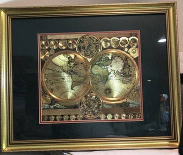
Sold2023Vintage GOLD FOIL WORLD MAP DOUBLE HEMISPHERE 25x31 FRAMED Wall HangingVintage Huge GOLD FOIL WORLD MAP DOUBLE HEMISPHERE 25x31 FRAMED Wall Hanging in a Gorgeous Gold Leaf Frame in VG Condition. Local Pickup Only in Berlin NJ 08009 or UPS Store Shipping Paid for by the WSee Sold Price
Sold2021Neele, J. 1834 Antique World Hemisphere MapSteel Engraved Map Published 1834, London for "The Universal Preceptor; or, General Grammar..." by the Rev. David Blair. Engraved by J. Neele. Folds as issued. Paper Size: 10.5 x 5.5 inch (27 x 14cm)See Sold Price
Jun 09Worthington GalleriesAntique Hand-colored Hemisphere Map Mappemonde Revue par E. Cortambert 1864$25
Featured2 days LeftJasper52c1720 World showing Dutch East India Co possessions. CA as a island. By J.Malherbe$600
Jun 09Worthington Galleries19th c. Hemisphere World Map, Hohen und Tiefen der Erde in Lambert’s Zenithal-Projection von$10
4 days LeftNY Elizabeth ANTIQUE MAP-ILLUSTRATED FLORAL ILLUSTRATION 1761 NEW DICTIONARY OF TRADE AND COMMERCE R. ROTH$50
Jun 09Worthington Galleries18th c. Map OBSERVATIONS SUR LES POINTS CARDINAUX. LIGNES, ET CIRCLES DE LA SPHÈ$10
Jun 09Worthington GalleriesFirst Edition Hand-colored Map THE NORTH RIDING OF YORKSHIRE by Robert Morden$50
2 days LeftJasper521693 Conelly Chart of the Earth and Geographic Principles -- Primi Elementi, o Introdutione al Corso$240
6 days LeftTrillium Antique Prints & Rare BooksSanson - Map of Canada or New France with the Great Lakes$75
6 days LeftTrillium Antique Prints & Rare BooksSanson - Map of Florida (encompassing most of Southeast North America)$75(1 bid)
6 days LeftTrillium Antique Prints & Rare BooksSanson - Map of the British Isles (Ireland, Scotland, England)$75
2 days LeftJasper521771 ASTRONOMY by Joseph M. de La Lande 2 VOLUMES ILLUSTRATED antique in FRENCH$480
Featured2 days LeftJasper521759 HISTORY OF THE WORLD in GERMAN antique ILLUSTRATED w/ MAP of ARABIA vellum$200
6 days LeftTrillium Antique Prints & Rare BooksKohler & Weigel - Map of the World with North and South Pole views$75(1 bid)
6 days LeftTrillium Antique Prints & Rare BooksDobson - Map of the World with Chart of Torrid Zone or Tropical Regions of the World$50


![Double hemisphere world map by Ruscelli, 1561: Heading: Author: Ruscelli, Girolamo Title: Orbis Descriptio Place Published: Venice Publisher: Date Published: 1561-[1574?] Description: Double-hemisphere copper-engraved w](https://p1.liveauctioneers.com/642/139321/70635504_1_x.jpg?height=310&quality=70&version=1554323736)