


Pittsburgh Plat Map Shadyside Fifth and Wilkins
Similar Sale History
View More Items in Maps & Atlases


![MS. map of Richmond District developments: Heading: -1870 Author: Title: Manuscript map/plat of a portion of the Richmond District, San Francisco, ownership, homestead associations, etc. Place Published: [San Francisco] Publisher: Date P](https://p1.liveauctioneers.com/642/242590/125758412_1_x.jpg?height=310&quality=70&version=1648613138)


![[STREETER COPY] SEARCY, I. G. Map of Florida constructed principally from authentic documents in the: [STREETER COPY] SEARCY, I. G. Map of Florida constructed principally from authentic documents in the Land office at Tallahassee by I. G. Percy. Published by I.G. Searcy Tallahassee & F. Lucas Jr., Bal](https://p1.liveauctioneers.com/292/250642/130213737_1_x.jpg?height=310&quality=70&version=1654271664)
![Gastaldi Map of Africa: *** START PRICE IS THE RESERVE *** [Africa]. GASTALDI, Giacomo (1500-1566) & FORLANI, Paolo (fl. 1560-1571). La Descrittione dell'Africa. Engraved Map. Venice: Paolo Forlani, 1562. 19 x 25 1/4 inches](https://p1.liveauctioneers.com/1968/163248/82424552_1_x.jpg?height=310&quality=70&version=1583340284)


Related Maps & Atlases
![(NEW YORK -- ADIRONDACK MOUNTAINS.) A Map of the Tottin & Crosfields Purchase & the Waters Adjacent: (NEW YORK -- ADIRONDACK MOUNTAINS.) A Map of the Tottin & Crosfields Purchase & the Waters Adjacent in the State of New-York. [Or Jessup's Patent]. Engraved map and survey plat of the enormous tract](https://p1.liveauctioneers.com/199/332329/179231665_1_x.jpg?height=310&quality=70&version=1717450360)


![[Philadelphia & Pennsylvania] Howell, Reading: A Map Of The State Of Pennsylvania: [Philadelphia & Pennsylvania] Howell, Reading: A Map Of The State Of Pennsylvania Howell, Reading A Map Of The State Of Pennsylvania… London: Published 1 August 1792 for the Author, & Sold by Ja](https://p1.liveauctioneers.com/65/332523/179335196_1_x.jpg?height=310&quality=70&version=1717622830)


![1636 Hondius Map of Southern Spain -- Andaluzia continens Sevillam et Cordubam: Title: 1636 Hondius Map of Southern Spain -- Andaluzia continens Sevillam et Cordubam Cartographer: Hondius [family] Year / Place: 1636, Amsterdam Map Dimension (in.): 13.8 X 19.4 in. This is a handso](https://p1.liveauctioneers.com/5584/331526/178834458_1_x.jpg?height=310&quality=70&version=1717530687)
![1885 Cram Map of New Mexico [verso] Arizona -- New Mexico [verso] Arizona: Title: 1885 Cram Map of New Mexico [verso] Arizona -- New Mexico [verso] Arizona Cartographer: G Cram Year / Place: 1885 c., Chicago Map Dimension (in.): 12.1 X 10.3 in. These two nice maps of Arizona](https://p1.liveauctioneers.com/5584/331526/178834526_1_x.jpg?height=310&quality=70&version=1717530687)
More Items in Maps & Atlases
View More
![[Maps & Atlases] Oliva, Joan: Portolan Chart of the Mediterranean: [Maps & Atlases] Oliva, Joan: Portolan Chart of the Mediterranean Oliva, Joan Portolan Chart of the Mediterranean Marseille, 1615. Illuminated manuscript portolan chart on vellum, in red, blue, green,](https://p1.liveauctioneers.com/65/332523/179335172_1_x.jpg?height=310&quality=70&version=1717709445)

![Set of Twelve Satirical Anthropomorphic Maps of Europe: [SATIRICAL MAPS] A set of twelve satirical anthropomorphic maps of Europe. London: circa 1868. A set of 12 (believed complete) lithographed maps by Vincent Brooks, Day & Son, London, each offering](https://p1.liveauctioneers.com/292/330597/178279264_1_x.jpg?height=310&quality=70&version=1716409282)


Recommended Transportation & Travel Collectibles
View More


Item Details
Description
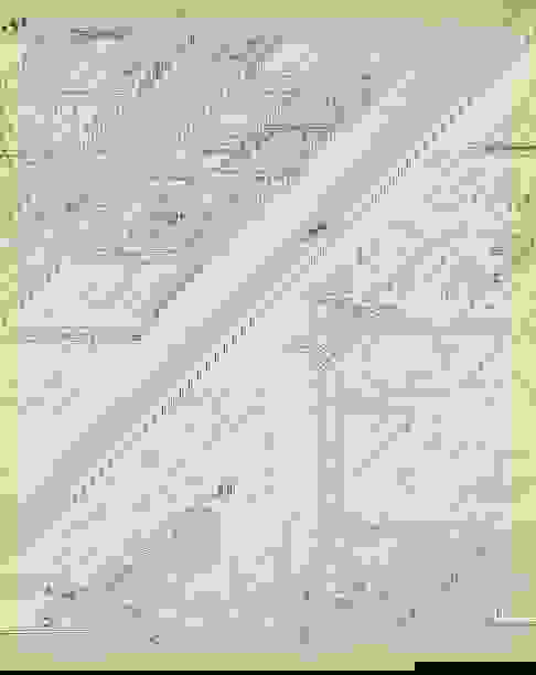
Plat Map of the Shadyside neighborhood of Pittsburgh, showing the triangular intersection of Wilkins and Fifth Avenues and surrounding areas, including parts of Walnut St., Dunmoyle and Beeler, c.1910, heavily faded hand coloring, 22.75 x 17.75 inches, floated in a frame 27 x 22.5 inches, features homes owned by Gillespie, Reed and other Pittsburgh luminaries.
Condition
Heavily faded coloring; losses to bottom edge; tear to lower left edge; age toned. Merchandise will be packed and transported by the purchaser at their own risk and expense. A list of recommended shippers is on our website: https://www.conceptgallery.com/auctions/shipping/ .
Buyer's Premium
- 27%
Pittsburgh Plat Map Shadyside Fifth and Wilkins
Estimate $200 - $300
4 bidders are watching this item.
Shipping & Pickup Options
Item located in Pittsburgh, PA, usShip with LiveAuctioneers
Arrange Your Own Shipping
Payment
Accepts seamless payments through LiveAuctioneers

Related Searches
TOP