![Europe after the Congress of Vienna. 4 sheets. 128x106cm. THOMSON 1817 old map: TITLE/CONTENT OF MAP: A map of Europe, with the political divisions after the Peace of Paris and Congress of Vienna [4 sheets] This very large map, printed on 4 sheets, shows a re-aligned Europe after](https://p1.liveauctioneers.com/5584/334148/180555781_1_x.jpg?height=310&quality=70&version=1719349709)
Maps & Atlases
![Europe after the Congress of Vienna. 4 sheets. 128x106cm. THOMSON 1817 old map: TITLE/CONTENT OF MAP: A map of Europe, with the political divisions after the Peace of Paris and Congress of Vienna [4 sheets] This very large map, printed on 4 sheets, shows a re-aligned Europe after](https://p1.liveauctioneers.com/5584/334148/180555781_1_x.jpg?height=310&quality=70&version=1719349709)
![1720 Strype Ward Map of Eastern portions of City of London -- Langborne Ward … [on sheet with]: Title: 1720 Strype Ward Map of Eastern portions of City of London -- Langborne Ward … [on sheet with] Candlewick Ward with its Division into Parishes. Corrected from the last Survey Cartographer](https://p1.liveauctioneers.com/5584/334149/180556505_1_x.jpg?height=310&quality=70&version=1719349709)
![HOLY ROMAN EMPIRE 1519. Europe upon Accession of Emperor Charles V 1902 map: TITLE/CONTENT OF MAP: 'Europe at the Accession of the Emperor Charles V. A.D. 1519' DATE PRINTED: 1902 IMAGE SIZE: Approx 25.5 x 34.5cm, 10 x 13.5 inches (Large) TYPE: Antique colour map. This map was](https://p1.liveauctioneers.com/5584/334148/180555672_1_x.jpg?height=310&quality=70&version=1719349709)
![ANTIQUE MAP OF VIRGINIA.: An old copy of John Smith’s map of Virginia, the original printed in 1606. The visible sheet size 15.5” x 19.5”, Image size 12.5” x 15.25”, Framed overall under glass 22&](https://p1.liveauctioneers.com/6170/333768/180430011_1_x.jpg?height=310&quality=70&version=1718835377)
![Isosahedral Map Patent Model: Joel Elmer Crouch (1899-1957), Cartographic inventor. Patented Icosahedral Map. Original box. Boxes overall 14" x 12" x 5", 12 1/2" x 15" x 6".](https://p1.liveauctioneers.com/1122/332252/179210630_1_x.jpg?height=310&quality=70&version=1717432170)
![COLONIAL CRAFTSMAN CIRCA 1940 MAP OF CAPE COD 21.5" x 27". Framed 23.5" x 29".: COLONIAL CRAFTSMAN CIRCA 1940 MAP OF CAPE CODShows Cape Cod, Martha's Vineyard and Nantucket, surrounded by vignettes of historic sites throughout the region.21.5" x 27". Framed 23.5" x 29".](https://p1.liveauctioneers.com/7634/333049/179792507_1_x.jpg?height=310&quality=70&version=1718199059)
![Colton's Atlas of the World, 1856, in Two Volumes; plus Africa / Mahdist War Map: 1st and 2nd Items: COLTON'S ATLAS OF THE WORLD, George Woolworth Colton, New York: J.H. Colton and Co., 1856. Two large folio volumes, bound in publisher's brown cloth, with gilt and blind sta](https://p1.liveauctioneers.com/525/332535/179370646_1_x.jpg?height=310&quality=70&version=1717684324)
![After William Faden, Revolutionary War Map of NY: After William Faden (British, 1749-1836), "A Plan of the Operations of the Kings Army under the Command of General Sr. William Howe, K.B. in New York and East New Jersey", copy on paper, 17 1/2" x 12"](https://p1.liveauctioneers.com/7247/333484/180078520_1_x.jpg?height=310&quality=70&version=1718412243)
![Bound Map of Columbia County: Large, hand-colored bound in map, Published my Dolph & Stewart.](https://p1.liveauctioneers.com/7247/333484/180078807_1_x.jpg?height=310&quality=70&version=1718412243)
![1914 Cram World Map -- The World on Mercator Projection: Title: 1914 Cram World Map -- The World on Mercator Projection Cartographer: G Cram Year / Place: 1914, New York, Chicago Map Dimension (in.): 17.8 x 26.2 in. Very nice world map, color-coding the cou](https://p1.liveauctioneers.com/5584/334149/180556523_1_x.jpg?height=310&quality=70&version=1719349709)
![1782 Walker Map of Playa Bay, Cape Verde Islands -- Praya Bay in the Island of St. Iago: Title: 1782 Walker Map of Playa Bay, Cape Verde Islands -- Praya Bay in the Island of St. Iago Cartographer: Walker (?) Year / Place: 1782, London Map Dimension (in.): 7.2 x 8.8 in. This is a very int](https://p1.liveauctioneers.com/5584/334149/180556517_1_x.jpg?height=310&quality=70&version=1719349709)
![1812. Map showing Roman London (Londinium Augusta): Map showing Roman London. Title: Londinium Augusta. Published by: Thomas Hurst. Production date: 1812. Size: 16,1x10,2 cms. Condition: good. Reserve: $63.00 Shipping: Domestic: Flat-rate of $25.00 to](https://p1.liveauctioneers.com/5584/334155/180558903_1_x.jpg?height=310&quality=70&version=1719349709)
![John Speed's 1676 Map of Virginia and Maryland: John Speed's 1676 Map of Virginia and Maryland copperplate engraving with color from Speed's Atlas of America, depicting the region in and around the Chesapeake Bay, with mountains real and imagined t](https://p1.liveauctioneers.com/250/333695/180278736_1_x.jpg?height=310&quality=70&version=1718649382)
![Two Early Maps of the American Revolution's Southern Theater: Two Early Maps of the American Revolution's Southern Theater to include: A New and Accurate Map of North Carolina and Part of South Carolina with the Field of Battle between Earl Cornwallis and Genera](https://p1.liveauctioneers.com/250/333695/180278744_1_x.jpg?height=310&quality=70&version=1718649382)
![English Cartographer John Russell's Map of the American South: English Cartographer John Russell's Map of the American South (London, circa 1795) titled Map of the Southern States of America, Comprehending Maryland, Virginia, Kentucky, Territory Sth of the Ohio,](https://p1.liveauctioneers.com/250/333695/180278742_1_x.jpg?height=310&quality=70&version=1718649382)
![Portrait of a Sea Captain Holding Caliper with Map: Portrait of a sea captain holding a caliper and pointing to a map. Period frame. Oil on canvas. American, circa 1845. Frame: H 33" W 27-3/4". Canvas: H 25-1/2 W 20-1/4". Condi](https://p1.liveauctioneers.com/6268/334338/180675271_1_x.jpg?height=310&quality=70&version=1719265391)
![A Jack Sayers' Pre-Opening WED Walt Disney World Map.: (Walt Disney World, 1968) A color presentation map of the early proposed layout of Walt Disney World with revisions. This map hung in the WED office of Jack Sayers, later Vice President of Lessee Rela](https://p1.liveauctioneers.com/4633/333131/179836686_1_x.jpg?height=310&quality=70&version=1719361660)
![ENGRAVING SURVEY MAP OF SOUTH CAROLINA AND GEORGIA: This original engraved map is a Survey of Chart no.55 from Hunting island to Ossabaw Island from South Carolina and Georgia. Issued: 1873 Dimensions: 43"L x 35.25"H Country of Origin: UNITED STATES](https://p1.liveauctioneers.com/6087/333784/180322518_1_x.jpg?height=310&quality=70&version=1718728239)
![1875 Mexico and Central America, Colombia and Panama by Hardesty: Title: 1875 Mexico and Central America, Colombia and Panama by Hardesty Date/Period: 1875 Materials: Hand color, steel engraving Size: 19 1/2 x 14” Mexico and Central America, and Colombia with](https://p1.liveauctioneers.com/5584/334149/180556525_1_x.jpg?height=310&quality=70&version=1719349709)
![EUROPE IN 1740. France England Holy Roman Empire Spain Ottomans &c 1902 map: TITLE/CONTENT OF MAP: 'Europe in 1740' DATE PRINTED: 1902 IMAGE SIZE: Approx 25.0 x 34.0cm, 9.75 x 13.5 inches (Large) TYPE: Antique colour map. This map was published in 1902 but it may depict an ear](https://p1.liveauctioneers.com/5584/334148/180555667_1_x.jpg?height=310&quality=70&version=1719349709)
![SCANDINAVIA. Sweden Norway.Railways.Scale in Swedish & Norwegian miles 1886 map: CAPTION PRINTED BELOW PICTURE: 'Sweden & Norway' DATE PRINTED: 1886 IMAGE SIZE: Approx 50.5 x 35.5cm, 20 x 14 inches (Large); Please note that this is a folding map. TYPE: Antique colour map CONDITION](https://p1.liveauctioneers.com/5584/334148/180555682_1_x.jpg?height=310&quality=70&version=1719349709)
![18th c. Hand Drawn Map of Africa: 18th c. hand drawn map of Africa. Signed ….Briggs. Sight 9 1/2" x 11 1/2", overall 11 1/2" x 13 1/2". Provenance: The Edward Herrmann Estate, Salisbury Connecticut.](https://p1.liveauctioneers.com/1122/332252/179210680_1_x.jpg?height=310&quality=70&version=1717432170)
![Vintage Wool Needlepoint Embroidered Map of Nantucket Island: Vintage Wool Needlepoint Embroidered Map of Nantucket Island, in Nantucket red, with Nantucket Island flag, and artist's signature daisy flower symbol lower left. Sight 9.5 in. x 15 in. Overall 16.5 i](https://p1.liveauctioneers.com/6681/333076/179801209_1_x.jpg?height=310&quality=70&version=1718285153)
![1874 Map of India: 1874 Map of India. Sight 16" x 14", overall 17 1/2" x 15". Provenance: The Edward Herrmann Estate, Salisbury Connecticut.](https://p1.liveauctioneers.com/1122/332252/179210672_1_x.jpg?height=310&quality=70&version=1717432170)
![M. Barclay-World Map Needlework on Silk: M. Barclay World map, needlework on silk. 1808. Frame: H 23-3/4" W 29-1/4". Sight: H 18-1/8" W 23-1/2". Condition: Excellent condition with minor imperfections. Copy](https://p1.liveauctioneers.com/6268/334338/180675304_1_x.jpg?height=310&quality=70&version=1719265391)
![Rare Antique 17th Century William Beery English Map of Bavaria: Rare Antique 17th Century William Beery English Map of Bavaria, Rare 2 sheet map of the Swabia region of Germany, published by William Berry in London. Entitled "Circle of Swabia", circa 1689, Berry's](https://p1.liveauctioneers.com/7116/334083/180514896_1_x.jpg?height=310&quality=70&version=1718979081)
![1747 Bellin Map of Guinea Coastal Region -- Suite de la Coste de Guinee Depuis la Riviere de Volta: Title: 1747 Bellin Map of Guinea Coastal Region -- Suite de la Coste de Guinee Depuis la Riviere de Volta Jusqu'a Jakin ou sont Les Royaumes de Koto, de Popo, de Whidah ou Juida, et d'Ardra Cartograph](https://p1.liveauctioneers.com/5584/334149/180556514_1_x.jpg?height=310&quality=70&version=1719349709)
![History of England: A new and enlarged edition. Publishers red cloth with gilt title to spine. Colour frontispiece fold-out map. Full-page colour maps. Fold-out and in-text maps. A very nice copy. Publisher: Longmans, Gr](https://p1.liveauctioneers.com/5584/334169/180568372_1_x.jpg?height=310&quality=70&version=1719349708)
![Battle of Jutland. Main Action. 7.12-7.18 pm 31 May 1916. WW1. 1923 old map: CAPTION PRINTED BELOW PICTURE: 'The Battle of Jutland. The Main Action. From 7.12 to 7.18 p.m' DATE PRINTED: 1923 IMAGE SIZE: Approx 23.0 x 36.5cm, 9 x 14.5 inches (Large); Please note that this is a](https://p1.liveauctioneers.com/5584/334148/180555681_1_x.jpg?height=310&quality=70&version=1719349709)
![5 TVA Map Books incl. Tennessee & New York c. 1935-1950: Five (5) Tennessee Valley Authority USGS quadrangle topographic map books, circa 1935-1950. 1st-4th items: Various Southern cities and counties including areas in and around Knoxville, Nashville,](https://p1.liveauctioneers.com/525/332535/179370647_1_x.jpg?height=310&quality=70&version=1717684324)
![Emanuel Bowen (English, 1697-1767), Map of the American Southeast: Emanuel Bowen (English, 1697-1767), Map of the American Southeastbeing A New & Accurate Map of the Provinces of North & South Carolina Georgia &c. (London, circa 1750), copperplate engraving with out](https://p1.liveauctioneers.com/250/333695/180278739_1_x.jpg?height=310&quality=70&version=1718649382)
![Two Early 19th Century Maps of North Carolina: Two Early 19th Century Maps of North Carolinato include: North Carolina From the Latest Surveys by Samuel Lewis, (Philadelphia: John Carey, 1814), hand colored, sheet size 16-3/4 x 21 in. unframed; pl](https://p1.liveauctioneers.com/250/333695/180278738_1_x.jpg?height=310&quality=70&version=1718649382)
![JOHN SPEED (1552 - 1629), BUCKINGHAM 17th Century Copper Engraving Hand Colored Town Plan Map: JOHN SPEED (1552 - 1629), BUCKINGHAM 17th Century Copper Engraving Hand Colored Town Plan Map. John Speed (1552-1629) is celebrated as one of the foremost English cartographers of the early modern per](https://p1.liveauctioneers.com/7277/331489/179404586_1_x.jpg?height=310&quality=70&version=1719573715)
![Imperii Romani Distracta pars Occidentalis. Roman Empire western. BONNE 1789 map: TITLE/CONTENT OF MAP: Imperii Romani Distracta, pars Occidentalis [Roman Empire, western part] DATE PRINTED: 1789 IMAGE SIZE: Approx 36.0 x 25.0cm, 14.25 x 9.75 inches (Large); Please note that this i](https://p1.liveauctioneers.com/5584/334148/180555669_1_x.jpg?height=310&quality=70&version=1719349709)
![1747 Bellin Map of Senegal River Systems -- Carte de l'Entrée de la Riviere de Sanaga ou: Title: 1747 Bellin Map of Senegal River Systems -- Carte de l'Entrée de la Riviere de Sanaga ou Senegal Cartographer: J Bellin Year / Place: 1747, Paris Map Dimension (in.): 8.8 x 5.9 in. This is](https://p1.liveauctioneers.com/5584/334149/180556519_1_x.jpg?height=310&quality=70&version=1719349709)
![1814 Carey Map of Southeast Asia and Northern Australia -- The Islands of the East Indies with the: Title: 1814 Carey Map of Southeast Asia and Northern Australia -- The Islands of the East Indies with the Channels between India, China & New Holland … Cartographer: M Carey Year / Place: 1814,](https://p1.liveauctioneers.com/5584/334149/180556507_1_x.jpg?height=310&quality=70&version=1719349709)
News about Maps & Atlases
![Historic maps and atlases chart course to Swann Dec. 7](https://www.liveauctioneers.com/news/wp-content/uploads/2023/11/165833907_1_x.webp)
Historic maps and atlases chart course to Swann Dec. 7
[av_heading heading=’Historic maps and atlases chart course to Swann Dec. 7′ tag=’h1′ style=” subheading_active=” show_icon=” icon=’ue800′ font=’entypo-fontello’ size=” av-desktop-font-size-title=” av-medium-font-size-title=” av-small-font-size-title=” av-mini-font-size-title=” subheading_size=” av-desktop-font-size=” av-medium-font-size=” av-small-font-size=” av-mini-font-size=” icon_size=” av-desktop-font-size-1=” av-medium-font-size-1=” av-small-font-size-1=” av-mini-font-size-1=” color=” custom_font=” subheading_color=” seperator_color=” icon_color=” margin=’,,35px,’ av-desktop-margin=” av-desktop-margin_sync=’true’ av-medium-margin=” av-medium-margin_sync=’true’ av-small-margin=’,,20px,’ av-mini-margin=” av-mini-margin_sync=’true’ headline_padding=” headline_padding_sync=’true’ av-desktop-headline_padding=” av-desktop-headline_padding_sync=’true’ av-medium-headline_padding=” av-medium-headline_padding_sync=’true’ av-small-headline_padding=” av-small-headline_padding_sync=’true’ av-mini-headline_padding=” av-mini-headline_padding_sync=’true’ […]
![Celebration of Scottish engineering on display at Lyon & Turnbull Feb. 7](https://www.liveauctioneers.com/news/wp-content/uploads/2024/01/Screenshot-2024-01-25-at-9.14.33 AM.png)
Celebration of Scottish engineering on display at Lyon & Turnbull Feb. 7
EDINBURGH – A cache of material from a well-known Scottish engineering dynasty will be offered at Lyon & Turnbull. The Rare Books, Manuscripts, Maps & Photographs auction on Wednesday, February 7 includes 50 lots from the Stevenson family – designers across four generations of many of the U.K.’s lighthouses. Absentee and Internet live bidding will […]
![Dickens & Twain set world records at Potter & Potter Aug. 28](https://www.liveauctioneers.com/news/wp-content/uploads/2021/09/395-1.jpg)
Dickens & Twain set world records at Potter & Potter Aug. 28
CHICAGO – Potter and Potter‘s spectacular August 28 Fine Books and Manuscripts Sale was the company’s highest-grossing auction to date. After a day of spirited bidding, 107 lots realized between $1,000-4,999; 22 lots realized between $5,000-9,999; and 16 lots broke the five digit mark.
![Jasper52 vintage map auction Nov. 5 going global](https://www.liveauctioneers.com/news/wp-content/uploads/2019/10/77325761_3_x.jpg)
Jasper52 vintage map auction Nov. 5 going global
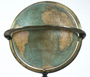
NEW YORK – A 19th century French terrestrial globe tops an auction of vintage maps that will be conducted by Jasper52 on Tuesday, Nov. 5. Fifteen globes and more than 130 maps and atlases are offered in the online auction. Bid absentee or live online exclusively through LiveAuctioneers.