BOOKS! MAPS! and MORE! 2018-08-29 Auction - 414 Price Results - Over & Above Online Auction and Estate Sales LLC in MD
LiveAuctioneers Logo

VERNE 20,000 LEAGUES UNDER THE SEAS - SMITH 1873VAN HEURCK "THE MICROSCOPE CONSTRUCTION MANAGEMENT"TABLE-TOP FOLDING WOOD  STEREOSCOPE
Done
Timonium, MD, United States
Auction Details

BOOKS! MAPS! and MORE!

Featuring: Scientific Books, Books on Microscopes, Engineering Books, Railroad Books, Atlases, Maps, Travel Books, Baltimore and Maryland Books, History Books, Machinist Catalogs, Natural History and Anatomy Books, Collection of Stereoviews - Including Egypt, China, Japan, European Views, World War I views, Anatomical Views, Humour, Natural Disasters, Battleships, Yosemite views, Parks, and more; Stereoviewers, too
Lot Number: Lowest
24
Sold
MARTINET'S MAP OF MARYLAND 1866: Martinet's Map of Maryland - Atlas Edition, Baltimore 1866; spine, edges and corners of cover have been reinforced with tape; interior binding is separating; toned with foxing; minor tearing and
0002: MARTINET'S MAP OF MARYLAND 1866Est. $50-$100
See Sold Price
Sold
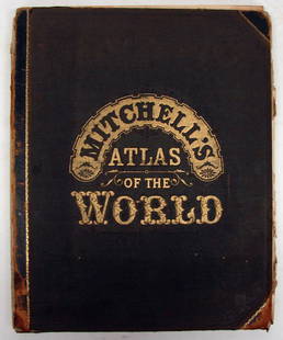
MITCHELL'S ATLAS OF THE WORLD 1883: Mitchell's Atlas of the World, Phila.; Wm. M. Bradley & Bro., 1883; front and back cover unattached and rough; some tattered page edges and creases; first blank page torn; toned; most pages remain
0003: MITCHELL'S ATLAS OF THE WORLD 1883Est. $20-$40
See Sold Price
Sold
ATLAS OF PENNSYLVANIA - WALLING, 1872: Atlas of Pennsylvania with descriptions, by Professor Henry F. Walling (Lafayete College) and O. W. Gray-Civil & Top'l Engineer, Phila.; published by stedman, Brown & Lyon; Philadelphia, 1872; both
0004: ATLAS OF PENNSYLVANIA - WALLING, 1872Est. $50-$100
See Sold Price
BUSINESS ATLAS, 1877: Rand , McNally & Cos's Business Atlas;1877; Referencde Map of World, entire Railroad System of North America; some maps are canvas backed and folded out; front cover unattached; (2) frontal pages
0007: BUSINESS ATLAS, 1877Est. $20-$40Lot Passed
Sold
THE COLUMBIAN WORLD'S FAIR ATLAS, 1893: The Columbian World's Fair Atlas, Mills & Lathrop Auburn, NY, 1893; spine has some tears on top and bottom; cover's corners are rough, interior binding is pulling away; pages toned; minimal edge
0010: THE COLUMBIAN WORLD'S FAIR ATLAS, 1893Est. $20-$40
See Sold Price
Sold
RAILROAD MAP OF PENNSYLVANIA, 1904: "Railroad Map of Pennsylvania - Published by the Department of Internal Affairs" 1904; cover has some gouges, mostly along right side; there is some edge roughness and fading; map has some creasing;
0011: RAILROAD MAP OF PENNSYLVANIA, 1904Est. $30-$60
See Sold Price
Sold
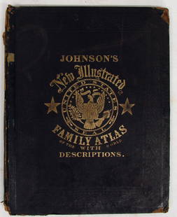
JOHNSON'S NEW ILLUSTRATED FAMILY ATLAS: Fisher, Richard Swainson; "Johnson's New Illustrated Family Atlas, with Physical Geography, and with Descriptions Geographical, Statistical, and Historical, Including the Latest Federal Census, A
0018: JOHNSON'S NEW ILLUSTRATED FAMILY ATLASEst. $100-$200
See Sold Price
Sold
(2) EARLY 1800'S MAPS OF DELAWARE: Includes: "Geographical, Historical, and Statistical Map of Delaware"; pencil writing identifies it as from Delaware - Carey and Lea, Philadelphia, 1822, (page 19); drawn by F. Lucas Jr., Engraved
0021: (2) EARLY 1800'S MAPS OF DELAWAREEst. $100-$200
See Sold Price
Sold
TOPOGRAPHICAL ATLAS OF MARYLAND, 1873: "New Topographical Atlas of the State of Maryland and the District of Columbia with Descriptions Historical, Scientific, and Statistical, Together with Maps of the United States and Territories" by
0022: TOPOGRAPHICAL ATLAS OF MARYLAND, 1873Est. $75-$125
See Sold Price
Sold
(4) LATE 1800'S MARYLAND MAPS: Includes: "Northeast District No. 5", includes vignette for Principio Furnace; loss to lower left corner; centerfold 26 3/8" x 16 1/4" (1) double sided atlas page, G. W. Gray & Son, 1876, page 61
0024: (4) LATE 1800'S MARYLAND MAPSEst. $75-$125
See Sold Price
View:
24
TOP