


Item Details
Description
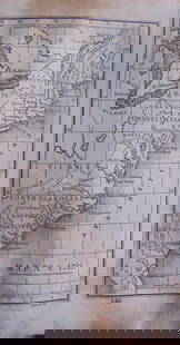
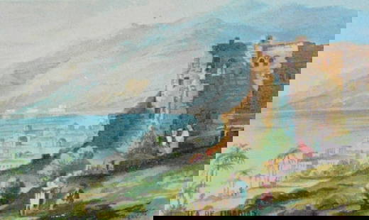
Map Exhibiting the New England Coast to Carolina
Map No. 4
Dated: Circa 1840
Dimensions: 6 x 4"
Condition Report Toning. Rounded left tips. Good
Subject References: 220
Map No. 4
Dated: Circa 1840
Dimensions: 6 x 4"
Condition Report Toning. Rounded left tips. Good
Subject References: 220
Buyer's Premium
- 25%
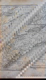
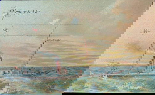
Map 1643 of New England Coast to Carolina
Estimate $200 - $300
Starting Price
$100
or 4 payments of $25.00 with 
1 bidder is watching this item.
Get approved to bid.
Shipping & Pickup Options
Item located in Otisville, NY, USOffers In-House Shipping
Payment
Accepts seamless payments through LiveAuctioneers
Auctioneer Announcement
Review our Saturday Auction

Spring Hudson Valley Estates Auction
Otisville, NY, USA


Related Maps & Atlases

![SELLER, JOHN. Two miniature hand-colored engraved maps: New England and New York [and] A New Mapp of: SELLER, JOHN. Two miniature hand-colored engraved maps: New England and New York [and] A New Mapp of the World. 5¾x6 and 5¾x6¾ inches each sheet size; double-page, blank versos; minor s](https://p1.liveauctioneers.com/199/332329/179231700_1_x.jpg?height=310&quality=70&version=1717450360)


![[Maps & Atlases] A New Map of North America, with the West India Islands...: [Maps & Atlases] A New Map of North America, with the West India Islands... A New Map of North America, with the West India Islands. Divided according to the Preliminary Articles of Peace, Signed at V](https://p1.liveauctioneers.com/65/332523/179335173_1_x.jpg?height=310&quality=70&version=1717709447)


More Items in Maps & Atlases
View More
![[Maps & Atlases] Oliva, Joan: Portolan Chart of the Mediterranean: [Maps & Atlases] Oliva, Joan: Portolan Chart of the Mediterranean Oliva, Joan Portolan Chart of the Mediterranean Marseille, 1615. Illuminated manuscript portolan chart on vellum, in red, blue, green,](https://p1.liveauctioneers.com/65/332523/179335172_1_x.jpg?height=310&quality=70&version=1717709445)


![Set of Twelve Satirical Anthropomorphic Maps of Europe: [SATIRICAL MAPS] A set of twelve satirical anthropomorphic maps of Europe. London: circa 1868. A set of 12 (believed complete) lithographed maps by Vincent Brooks, Day & Son, London, each offering](https://p1.liveauctioneers.com/292/330597/178279264_1_x.jpg?height=310&quality=70&version=1716409282)


Recommended Transportation & Travel Collectibles
View More


Related Searches
TOP