


1812 Hand Colored Map Holy land
Similar Sale History


Recommended Items


![[MAP]. ORTELIUS, Abraham. Presbiteri Iohannis, sive, Abissinorum Imperii Descriptio. 1592.: [MAP]. ORTELIUS, Abraham. (1527-1598). Presbiteri Iohannis, sive, Abissinorum Imperii Descriptio. Antwerp, 1592. Engraved map with hand-coloring. Matted, framed, and double glazed, visible area 406 x](https://p1.liveauctioneers.com/197/329395/177650536_1_x.jpg?height=310&quality=70&version=1715364962)


Item Details
Description
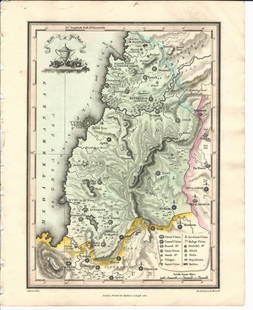
Handcolored map of the “Tribe of Manasseh” in the Holy land , printed by Mathews and Leigh, 1812. Measures 11 x 9”.
Condition
Fine
Buyer's Premium
- 10%
1812 Hand Colored Map Holy land
Estimate $40 - $60
1 bidder is watching this item.
Shipping & Pickup Options
Item located in Various, NY, usSee Policy for Shipping
Payment

Related Searches
TOP