Sold20161862 Walling Pennsylvania Topographical Wall MapDESCRIPTION: 1862 Topographical Map of the State of Pennsylvania Drawn to the Actual Surveys by H.F. Walling. Published by Smith, Palmer & Co. Includes the following inset maps: Climatological Map bySee Sold Price
Sold20241859 Clark & Hopkins Wall Map Litchfield County CTAntique 1859 Clark & Hopkins Topographical Wall Map of Litchfield County Connecticut, Coated Fabric Backed Paper with Original Rollers. Measures 55 inches x 51 inches. Please note condition issues notSee Sold Price
Sold20241859 Clark & Tackaburys' Wall Map of ConnecticutAntique 1859 Clark & Tackabury Topographical Wall Map of Connecticut, Coated Paper with Original Rollers. Measures 55 inches x 71 inches. Please note condition issues noted in photography including teSee Sold Price
Sold20161930s Crams Superior Pennsylvania School Wall MapDESCRIPTION: George Cram Markable-Washable Superior Pennsylvania school wall map. With census, regions, and population information at bottom. Printed by George Cram Co. Indianapolis, Indiana. MEASUREMSee Sold Price
Sold20231894 Cowles Civil War Map of Northern Virginia, Maryland, Delaware and Parts of West Virginia andTitle: 1894 Cowles Civil War Map of Northern Virginia, Maryland, Delaware and Parts of West Virginia and Pennsylvania -- General Topographical Map, Sheet I [Plate CXXXVI] Cartographer: C Cowles (compiSee Sold Price
Sold20201858 WALLING NORFORK COUNTY WALL MAP:1858 HENRY F. WALLING NORFOLK COUNTY MASSACHUSETTS HANGING WALL MAP: Measures 60 inches x 64 inches. Side insert maps, Quincy, Dedham, Brookline, Roxbury, Jamaica Plain & etc. Fading, wear,wrinkles, wSee Sold Price
Sold2022HF Walling Chittenden Co. VT Wall MapLarge HF Walling Circa 1857 Wall map, missing rollers but nicely framed. (Please note the size when purchasing. ) 53 x 56" 62 x 66" as framed .See Sold Price
Sold20221910 Railroad Map of Pennsylvania by Wall -- RailroadTitle: 1910 Railroad Map of Pennsylvania by Wall -- Railroad Map of Pennsylvania Published by the Department of Internal Affairs of Pennsylvania Cartographer: J S Wall / PA Dept. of Internal Affairs YSee Sold Price
Sold2016Large 1862 US Civil War Wall MapColton's Map of the Southern States. Including Maryland, Delaware, Virginia, Kentucky, Tennessee, Missouri, North Carolina, South Carolina, Georgia, Alabama, Mississippi, Arkansas, Louisiana, Texas ..See Sold Price
Sold2022HF Walling Essex Co, VT Wall Map1859 Large HF Walling map of Essex, Orleans and Lamoille Co VT With Rollers in as found condition with creases, and yellowing appropriate to this sort of map 56 x 53"See Sold Price
Sold20241875 Walling and Gray Pennsylvania County Maps -- Atlas of Pennsylvania Counties of Chester,Title: 1875 Walling and Gray Pennsylvania County Maps -- Atlas of Pennsylvania Counties of Chester, Dauphin, Berks, Lebanon, York and Lancaster [with] Cumberland Fraklin and Adams Cartographer: WallinSee Sold Price
Sold20231862 Civil War, Coltons New Topographical Map of The States of Virginia, Maryland and DelawareHistoric Maps 1862 Civil War "Colton's New Topographical Map of The States of Virginia, Maryland and Delaware" Hardcover Folio 1862-Dated Civil War Period, Hand-colored 45.25" x 31.5" Folding Map titlSee Sold Price
Sold20181859 Clark & Tackabury Antique Connecticut Wall MapTitle/Content of Map: 1859 Clark & Tackabury Connecticut Wall Map -- Clark & Tackabury's New Topographical Map of the State of Connecticut Date Printed: 1859 Philadelphia Cartographer: Clark and TackaSee Sold Price
Sold2023VERY RARE WALL MAP OF THE CITY OF BANGOR,PENOBSCOT COUNTY, MAINE. 1853, Bangor, Maine. "Published Under the Patronage of the City Government Henry F. Walling, Civil Engineer, 81 Washington St. Boston 1853". "S.S. Smith, Publisher 17 West MarSee Sold Price
Sold20221858 Walling Map of Washington County, VT1858 Walling map of Washington County, Vermont, full size roll-up wall map on original boads, flaking, losses, width 56 1/2", ht 54"See Sold Price
Sold202219th C Kittanning, Pennsylvania MapItem/Description: Framed antique wall map features nine building insets including the old courthouse, churches and residences. "Map of Kittanning Armstrong Co. Penna. Surveyed, drawn & published by ThSee Sold Price
Sold2018Antique Clark & Tackabury Connecticut Map,1859Antique Clark & Tackabury's, 1859, "New Topographical Map of the State of Connecticut", attached to wooden rod with acorn finials. Note: Complete and very informative colored wall map of Connecticut,See Sold Price
Sold2020Anthracite Fields of PAGeographical and Topographical map of the Anthracite Fields of Pennsylvania, constructed from original explorations and instrumental surveys by Henry D Rogers, state geologist, 1858. Has some discolorSee Sold Price
Sold2016ALFRED BRYAN WALL O/BSHEEP FLOCK WITH SHEPHERD - CARNEGIE INSTITUTE - 1862-1935 PENNSYLVANIA Dimensions:10"X14"See Sold Price
Sold20171936 Japanese Showa Period Map of ChinaItem: 1936 Japanese Showa Period Map of China Description: An interesting map of China, showing topographical features, the Great Wall, cities, railroads and sea routes. Insets are the regions of ChinSee Sold Price
Sold2023Group lot of NEW YORK State Topographical MapsGroup lot of NEW YORK State Topographical Maps, maps measure 17 x 21 inches, wear consistent with age and use. not framed. Art, wall art, artwork, home decor, maps, topographic, topography, New York SSee Sold Price
Sold2022Group lot of NEW YORK State Topographical MapsGroup lot of NEW YORK State Topographical Maps, maps measure 17 x 21 inches, wear consistent with age and use. not framed. Art, wall art, artwork, home decor, maps, topographic, topography, New York SSee Sold Price
Sold2017LOUIS PRANG (AMERICAN, 1824-1909) CIVIL WAR MAPLOUIS PRANG (AMERICAN, 1824-1909) CIVIL WAR MAP "War Telegram Marking Map", depicting eastern Virginia and Maryland with topographical features and rail lines, published 1862 by L. Prang & Co., purchaSee Sold Price
Sold2017Antique Map of Philadelphia and Camden, Walling, 18721872 Map of the Compact Portions of Philadelphia and Camden, Walling. Very nice example with good margins and very clean. Hand-colored map was originally published in the 1872 "New Topographical AtlasSee Sold Price
2 days LeftSwann Auction Galleries(RHODE ISLAND.) Henry F. Walling. Map of the State of Rhode Island and Providence Plantations.$500
2 days LeftSwann Auction Galleries(NEW YORK.) Amos Lay. Map of the State of New York with Part of the States of Pennsylvania, New$500
2 days LeftSwann Auction Galleries(NEW JERSEY.) William Kitchell; and Robert Pearsall Smith. Topographical Map of the State of New$600
2 days LeftSwann Auction Galleries(NEW JERSEY.) Group of 3 mid-nineteenth-century wall maps of Garden State counties.$900
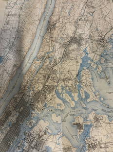
2 days LeftSwann Auction Galleries(TRI-STATE AREA.) A.R. Ohman Map Co. Map Showing 100 Miles Around New York City.$450
15 hrs LeftDan Morphy AuctionsBRUE'S MONUMENTAL WALL MAP OF TEXAS, UPPER CALIFORNIA & MEXICO, C. 1845$500(1 bid)
2 days LeftSwann Auction Galleries(NEW YORK CITY.) Jacob Barnitz Bacon. Pier Map of the City of New York, Surveyed and Drawn for the$19,000
Jun 23Schilb Antiquarian Rare Books1877 Geology Geography Surveys 1ed Nevada Wyoming Utah George Wheeler US West 2v$1(1 bid)
Jun 25Freeman's | Hindman[Philadelphia & Pennsylvania] Howell, Reading: A Map Of The State Of Pennsylvania$3,500
Featured1 day LeftJasper52The country round Philadelphia. New Jersey Pennsylvania NY. GENTS MAG 1776 map$320
Featured2 hrs LeftJasper521775-1780. New York, New Jersey, Pennsylvania, Maryland, Virginia and New England states. By Bonne &$120(1 bid)
2 hrs LeftJasper52North America Sheet III West Canada With Parts of New York, Pennsylvania and Michigan$30
Featured2 hrs LeftJasper52Map Illustrative of the Statistics of the Coal Trade Of Pennsylvania.$35(1 bid)


![1894 Cowles Civil War Map of Northern Virginia, Maryland, Delaware and Parts of West Virginia and: Title: 1894 Cowles Civil War Map of Northern Virginia, Maryland, Delaware and Parts of West Virginia and Pennsylvania -- General Topographical Map, Sheet I [Plate CXXXVI] Cartographer: C Cowles (compi](https://p1.liveauctioneers.com/5584/300803/160207035_1_x.jpg?height=310&quality=70&version=1693946338)


![1875 Walling and Gray Pennsylvania County Maps -- Atlas of Pennsylvania Counties of Chester,: Title: 1875 Walling and Gray Pennsylvania County Maps -- Atlas of Pennsylvania Counties of Chester, Dauphin, Berks, Lebanon, York and Lancaster [with] Cumberland Fraklin and Adams Cartographer: Wallin](https://p1.liveauctioneers.com/5584/319185/171438575_1_x.jpg?height=310&quality=70&version=1707858212)


![[Philadelphia & Pennsylvania] Howell, Reading: A Map Of The State Of Pennsylvania (1 of 2)](https://p1.liveauctioneers.com/65/332523/179335196_1_x.jpg?height=282&quality=70&version=1717622830)


