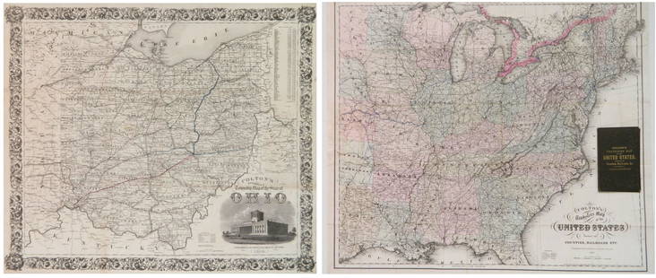
BOURNE, Alexander and KILBOURNE, John. Map of the State of Ohio Drawn by A. Bourne. Including the
Similar Sale History
View More Items in Maps & Atlases


Related Maps & Atlases
More Items in Maps & Atlases
View MoreRecommended Transportation & Travel Collectibles
View More


Item Details
Description
BOURNE, Alexander and KILBOURNE, John. Map of the State of Ohio Drawn by A. Bourne. Including the Indian Reservations, Purchased and laid out into Counties and Townships in 1820. Drawn by J. Kilbourne. Windsor, Connecticut, circa 1820.
Engraved map of Ohio, visible area 19 1/4 x 16 3/4 inches.
showing the absorption of Indian land in northwestern Ohio, along with the state's 70 counties, major roadways, rivers, vegetation, and important settlements, along with particularly clear topographical details.
from Caleb Atwater's Description of the Antiquities Discovered in the State of Ohio…, Volume I of the American Antiquarian Society's Archaeologia Americana, first published in 1820.
Property from the Robert and Nancy Treichler Collection of Ohio Stoneware and Americana, Tallmadge, Ohio
Condition
Framed: 25 x 22 inches.
Buyer's Premium
- 31% up to $1,000,000.00
- 25% up to $4,000,000.00
- 19% above $4,000,000.00
BOURNE, Alexander and KILBOURNE, John. Map of the State of Ohio Drawn by A. Bourne. Including the
Estimate $300 - $500
8 bidders are watching this item.
Shipping & Pickup Options
Item located in Cincinnati, OH, usSee Policy for Shipping
Payment
Accepts seamless payments through LiveAuctioneers

Related Searches
TOP


![[MAP]. TODESCHI, Pietro. [Nova et Acurata Totius Americae Tabula auct. G.I. Blaeu] America quarta: [MAP]. TODESCHI, Pietro. [Nova et Acurata Totius Americae Tabula auct. G.I. Blaeu] America quarta pars orbis quam plerunq, nuvum orbem appellitant primo detecta est anno 1492 a Christophoro Columbo...](https://p1.liveauctioneers.com/197/329395/177650542_1_x.jpg?height=310&quality=70&version=1715364962)


![[MAPS]. HOMANN, Johann Baptist, HOMANN HEIRS, and Georg Matthäus SEUTTER. [Composite Atlas].: [MAPS]. HOMANN, Johann Baptist (1663-1724), HOMANN HEIRS, and Georg Matthäus SEUTTER (1678-1757). [Composite Atlas]. [Nuremberg, Augsburg, and others: Homann Heirs and others, maps dated between](https://p1.liveauctioneers.com/197/329395/177650530_1_x.jpg?height=310&quality=70&version=1715364962)
![[MAP]. ORTELIUS, Abraham. Americae Sive Novi Orbis, Nova Descriptio. 1573.: [MAP]. ORTELIUS, Abraham (1527-1598). Americae Sive Novi Orbis, Nova Descriptio. Antwerp, 1573. Engraved map with hand-coloring. Framed and double glazed, visible area 375 x 521 mm (unexamined out of](https://p1.liveauctioneers.com/197/329395/177650534_1_x.jpg?height=310&quality=70&version=1715364962)


![[MAP]. ORTELIUS, Abraham. Turcici Imperii Descriptio.1592.: [MAP]. ORTELIUS, Abraham (1527-1598). Turcici Imperii Descriptio. Antwerp, 1592. Engraved map with hand-coloring. Matted, framed, and double glazed, sight 406 x 521 mm (unexamined out of frame). Decor](https://p1.liveauctioneers.com/197/329395/177650538_1_x.jpg?height=310&quality=70&version=1715364962)

![[MAP]. ORTELIUS, Abraham. Aevi Veteris, Typus Geographicus. 1601.: [MAP]. ORTELIUS, Abraham (1527-1598). Aevi Veteris, Typus Geographicus. Antwerp, 1601. Engraved map with hand-coloring. Matted, framed, and double glazed, visible area 343 x 470 mm (unexamined out of](https://p1.liveauctioneers.com/197/329395/177650532_1_x.jpg?height=310&quality=70&version=1715364962)


![[FLAGS]. 31-star American parade flag. Ca 1850-1859.: [FLAGS]. 31-star American parade flag. Ca 1850-1859. 22 x 36 1/2 in. cotton flag with 31 printed stars, configured in a double medallion surrounding a much larger central star, that is haloed in both](https://p1.liveauctioneers.com/197/329785/177758218_1_x.jpg?height=310&quality=70&version=1715625218)


